
Cahokia: The Lost City on the Mississippi
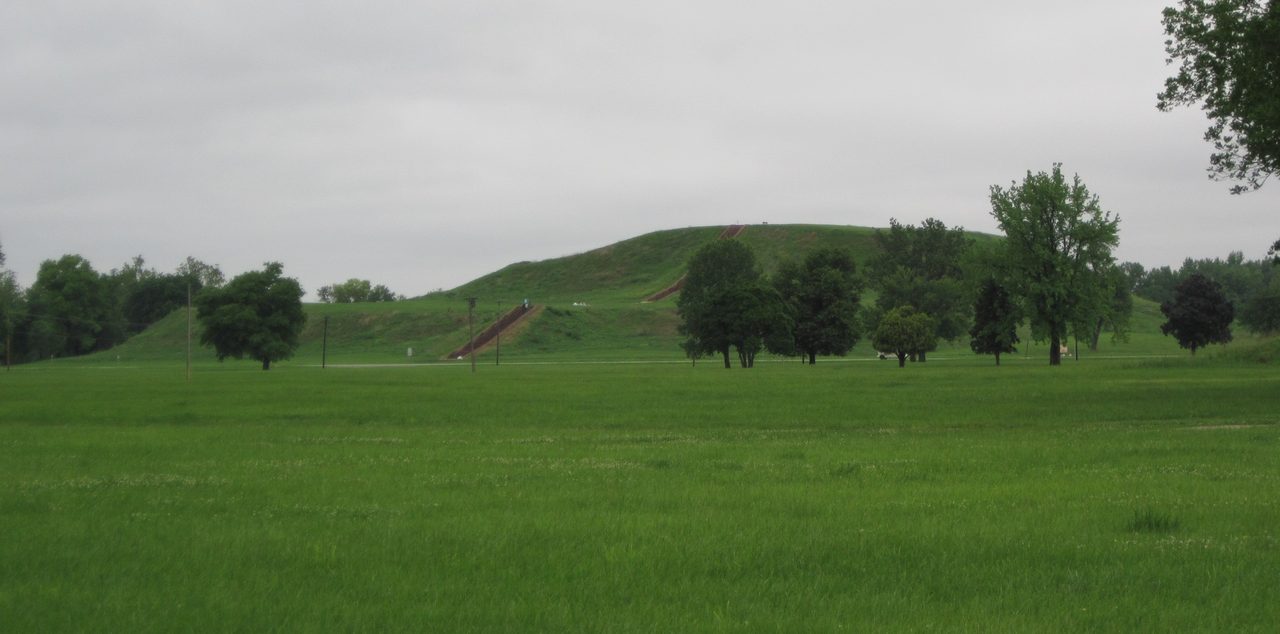
Around 1050 CE, on the Mississippi floodplain near present-day Collinsville, Illinois, a settlement became a city inside what may have been a single generation. Timothy Pauketat calls that transformation Cahokia's Big Bang. At its height the place covered about 6 square miles and carried population estimates of 10,000 to 20,000 in the city proper, comparable in population to medieval London, and it remained the largest city in what is now the United States until Philadelphia surpassed it in the late 18th century, more than 500 years later. Its builders raised the largest pre-Columbian earthwork north of Mexico by hand, in woven baskets, without draft animals and without wheels, and set timber circles that mark the solstice and equinox sunrises. Then, across the mid-to-late 1300s and by some readings into the early 1400s, they left. No deciphered writing survives from Cahokia, so no name the city gave itself has come down to us, and no account of the leaving. What came down instead is over 270 burials in one small mound, copper from the Great Lakes and shell from the Gulf, caffeine from a plant that grows far to the south, and an unresolved argument about whether this was a state or a chiefdom. This article carries all of it at the tier the evidence earns, corrects a dimension our own primary file states wrongly, and says plainly where our three files disagree with each other about when the city ended.
Most files in this wing open on a place that is hard to find. This one opens on a place you can drive to. Cahokia stands near present-day Collinsville, Illinois, next to East St. Louis. It has been a UNESCO World Heritage Site since 1982, and the reconstructed timber circle on its grounds still hosts public sunrise gatherings at the solstices and the equinoxes. What is lost here is not the location. It is the account. At its height this was the largest pre-Columbian settlement north of Mexico, roughly 6 square miles of city, and it remained the largest city in what is now the United States until Philadelphia surpassed it in the late 18th century, more than 500 years later. Then, at some point in the 1300s, it emptied, and our own three files do not agree with each other about when. The people who built it left no writing that anyone has deciphered, so the city's own name for itself did not come down to us, and neither did any account of the leaving. What came down instead is what they built, what they buried, and what they carried in from the Gulf coast and the Great Lakes. This file is an attempt to say exactly how far that gets us, claim by claim, at the tier the evidence earns. Let's open it.
01The City On the Bottomland
Cahokia sits near present-day Collinsville, Illinois, adjacent to East St. Louis. Our three files agree, without qualification, that it was the largest pre-Columbian settlement north of Mexico: approximately 6 square miles, about 16 square kilometers, with a core ceremonial precinct surrounded by residential neighborhoods. Cahokia Mounds was designated a UNESCO World Heritage Site in 1982. Everything else in this article rests on that paragraph, and it is worth being clear about what kind of paragraph it is. The site is not a candidate location, not a rumor, and not a reading of an ambiguous text. It is a mapped, excavated, protected archaeological landscape. The arguing starts only once you ask what happened on it.
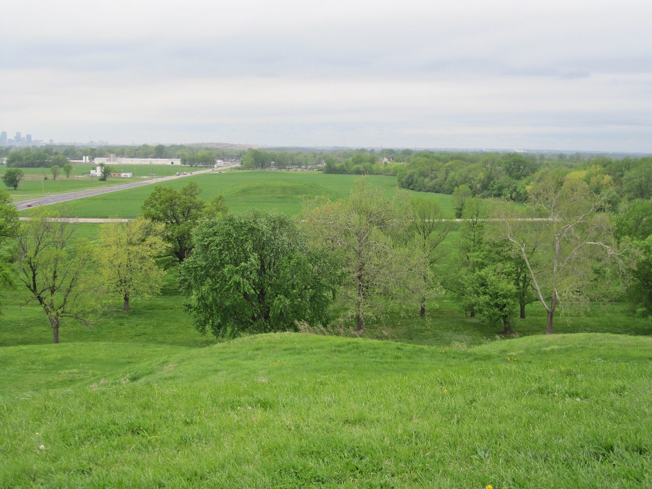
Population estimates at Cahokia's zenith, roughly 1050 to 1200 CE, run from 10,000 to 20,000 within the city proper, with some scholars arguing for up to about 40,000 once satellite communities within a roughly 50 km radius are counted in. That range is what makes the comparison everyone reaches for defensible: Cahokia was contemporary with medieval London and comparable to it in population. Checked independently during this article's research pass, London's own population circa 1100 CE comes out at roughly 10,000 to 15,000, with some estimates running 14,000 to 18,000. So the careful form of the claim is comparable to, not definitively larger than. Both figures carry real uncertainty, and stacking one uncertain number on another to declare a winner would be a weaker claim than the one the evidence already supports. Our second file adds a comparison that needs no uncertainty at all: Cahokia was the largest city in what is now the United States until Philadelphia surpassed it in population in the late 18th century, more than 500 years later.
Hold that range loosely. In section 06 a named archaeologist argues it is inflated and puts the peak at 5,000 to 8,000, and this article carries his figure too, at its own tier, rather than averaging the two into a single number nobody defends.
02Monks Mound, and a Number This Article Corrects
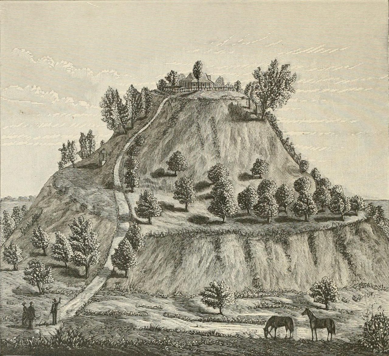
Monks Mound is the largest pre-Columbian earthwork north of Mexico. It stands approximately 100 feet high, 30 to 30.5 meters, in four terraces, on a base of roughly 955 feet by 775 feet, 291 by 236 meters, covering about 14 to 15 acres, 5.7 to 6.1 hectares. It was built in stages between approximately 900 and 1200 CE, and the earth moved to raise it is estimated at 22 million cubic feet, roughly 622,000 to 623,000 cubic meters, carried entirely by hand in woven baskets, without draft animals and without wheeled vehicles. Now the correction, stated where a reader can watch it happen. Our primary file for this article gives the base as over 950 feet long by 650 feet wide. The 650 foot width does not hold. Both of our secondary files independently give the base as 291 by 236 meters, and 236 meters is approximately 775 feet, not 650, and independent checking during this article's research pass converges on 955 by 775 feet as the standardized 1988 measurement. This article uses 775 feet. The primary file's own height and volume figures for the mound are compatible with either width, since the mound's real footprint is irregular rather than a clean rectangle; the correction rests on the two secondary files' independent agreement plus the standardized 1988 survey, not on the primary file contradicting itself elsewhere, which is what makes the 650 look like a single transcription slip rather than a rival survey.
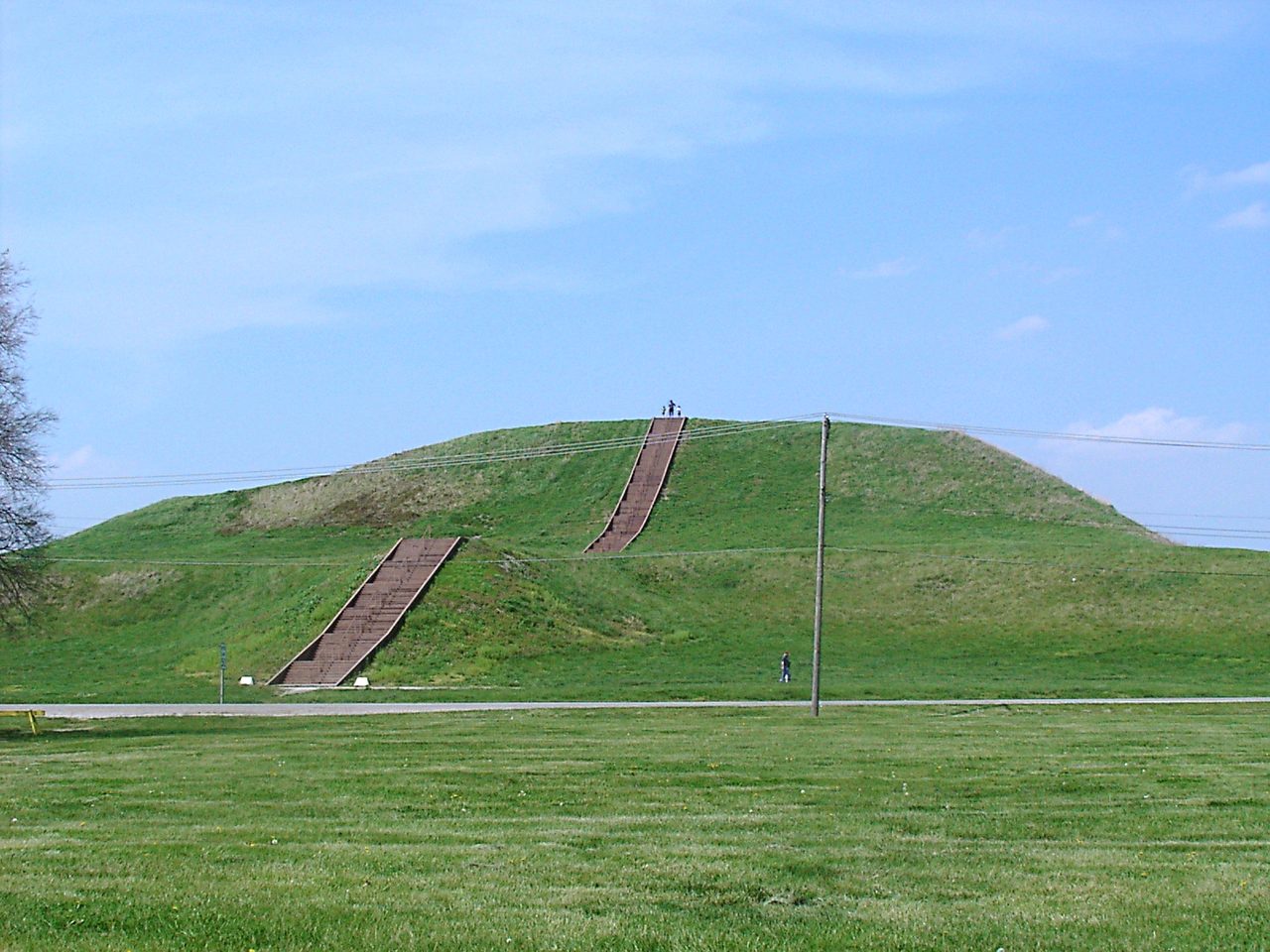
Soil analyses of Monks Mound show that different clay types were deliberately layered to manage drainage and structural stability, which contradicts an earlier assumption that the mound was simple, undifferentiated earthen piling. This article is not a construction study and will not become one here, because what that finding contributes to a story about a lost city is not really about technique. Somebody understood the material well enough to sequence it. Somebody organized the movement of 22 million cubic feet of soil, one basket at a time, across roughly three centuries of staged work. That is a population fact, an authority fact, and a duration fact, and it is the first hard corroboration that the numbers in section 01 are not fantasy.
One more thing about those dates, because it sets the shape of everything after. Monks Mound's staged construction runs from about 900 to about 1200 CE. The rapid transformation Timothy Pauketat calls the Big Bang, which section 04 takes up at Tier 2, is dated around 1050. So the mound was going up for roughly 150 years before that moment and roughly 150 years after it. Whatever happened around 1050 happened to a place that was already building.
03The Plaza and the Timber Circles
South of Monks Mound lies the Grand Plaza, a leveled public space covering approximately 19 hectares, roughly 47 acres, which our file records as one of the largest public spaces in pre-Columbian North America. It is not a natural clearing. Geophysical surveys and excavations led by Rinita Dalan, published in 2003, showed that the plaza was deliberately engineered, with layers of colored clay fill leveling the original terrain. The mounds are the labor everyone sees. The flat ground beside them is the labor nobody looks at, and our file reads it as evidence of massive coordinated work beyond the mounds themselves.
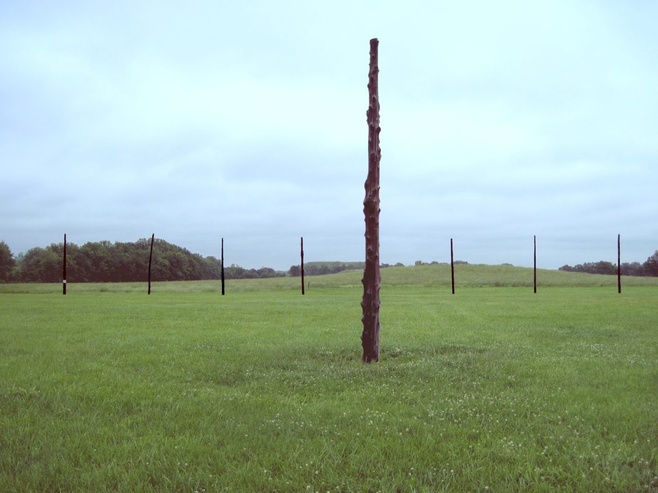
West of Monks Mound, Warren Wittry identified a series of large post pits during excavations in the 1960s, dated to 1961 in one of our files, and the pits formed timber circles. They were named Woodhenge, by analogy with Stonehenge. At least five successive circles, Woodhenge I to V, were built between approximately 900 and 1100 CE, using red cedar posts arranged to mark solstice and equinox sunrise alignments as observed from a central observation post. The largest of the reconstructed circles contained 48 posts at a diameter of approximately 128 meters. One circle was physically reconstructed in 1985 using the original excavated postholes, and it hosts public solstice and equinox sunrise observation events to this day. Note where the tiers fall here, because it is easy to get backwards. The solar alignments at Woodhenge sit at Tier 1 in our files. The stellar alignments proposed elsewhere on the site sit at Tier 3, and section 09 keeps them there.
| Item | The Figure, As This Article Uses It |
|---|---|
| Location | Near present-day Collinsville, Illinois, adjacent to East St. Louis |
| Site Extent | Approximately 6 square miles, about 16 square kilometers, with a core ceremonial precinct surrounded by residential neighborhoods |
| Peak Population (the Tier 1 Range) | 10,000 to 20,000 in the city proper at the zenith, roughly 1050 to 1200 CE; up to about 40,000 counting satellite communities within a roughly 50 km radius |
| Peak Population (the Tier 2 Counter-Estimate) | 5,000 to 8,000, argued by George Milner from residential-structure density analysis. Carried separately rather than averaged into the range above |
| Monks Mound | The largest pre-Columbian earthwork north of Mexico. Approximately 100 feet, 30 to 30.5 m, tall in four terraces, on a base of roughly 955 by 775 feet, 291 by 236 m, covering about 14 to 15 acres, 5.7 to 6.1 hectares |
| The Corrected Dimension | Our primary file gives the base as over 950 feet long by 650 feet wide. Both secondary files give 236 m, which is approximately 775 feet, and independent checking converges on 955 by 775 feet. This article uses 775 feet |
| The Earth Moved | An estimated 22 million cubic feet, roughly 622,000 to 623,000 cubic meters, carried by hand in woven baskets, without draft animals or wheeled vehicles |
| Construction Window | Monks Mound built in stages between approximately 900 and 1200 CE |
| The Grand Plaza | Approximately 19 hectares, roughly 47 acres, deliberately leveled with layers of colored clay fill (Dalan and colleagues, 2003) |
| Woodhenge | At least five successive circles, Woodhenge I to V, between approximately 900 and 1100 CE. The largest of the reconstructed circles held 48 red cedar posts at a diameter of approximately 128 m; one circle was reconstructed in 1985 using the original excavated postholes |
| Mound 72 | A small ridgetop mound about 850 m south of Monks Mound, holding over 270 burials |
| Trade Reach | Over 1,500 km. Marine shell from the Gulf of Mexico, copper from the Great Lakes, galena from Missouri, chert from various Midwest sources |
| Maize In the Diet | 40 to 65 percent of dietary calories, from stable isotope analysis of Mississippian burials |
| World Heritage | Cahokia Mounds designated by UNESCO in 1982 |
04The Crop, and the Big Bang
A city that size on that floodplain needed a crop, and the timing of the crop is specific. Mississippian societies depended on intensive maize agriculture. Maize reached the eastern woodlands from Mesoamerica by way of the Southwest by approximately 200 CE, but it was not intensively cultivated until cold-adapted, short-growing-season Northern Flint varieties emerged after 800 CE. Stable isotope analysis, delta-13C, of Mississippian burials shows maize supplying 40 to 65 percent of dietary calories, a figure measured in the bones of the people who ate it. Gayle Fritz documented in 2019 what came before it: the Eastern Agricultural Complex, the cultivation of goosefoot, sunflower, sumpweed and squash, native plants grown long before maize was farmed intensively, gradually supplanted by it and continuing alongside it as supplementary agriculture. Read the two dates together and the sequence is hard to miss. The plant is present from around 200 CE and does very little. A cold-tolerant variety appears after 800 CE, and within roughly two and a half centuries the largest settlement north of Mexico is going up on the bottomland.
Around 1050 CE, Cahokia went through a rapid transformation that Timothy Pauketat has named the city's Big Bang. Population surged, monumental construction accelerated, and the site plan was reorganized around a new cosmological template, all inside roughly a generation. Pauketat has further proposed that this may be linked to a supernova observation, SN 1054, the event that produced the Crab Nebula. Our file is explicit about the standing of that second step: the chronological correlation is suggestive rather than demonstrated causation. That is the right way to hold it. A sky that changes and a city that reorganizes inside the same decade is a striking coincidence and an untested hypothesis at once, and nothing about the first claim, the transformation itself, depends on the second one being true.
05What Came In, and What Went Out
Cahokia's trade connections span over 1,500 km, and they are demonstrable because the materials themselves are traceable. Marine shell from the Gulf of Mexico, copper from the Great Lakes, particularly Isle Royale and the Keweenaw Peninsula, galena from Missouri, and chert from various Midwest sources have all been recovered at the site. The flow ran outward as well: John Kelly and colleagues documented the wide distribution of Ramey Incised pottery across the Mississippian world as further evidence of the same exchange network. A settlement that imports Gulf shell and Great Lakes copper while its own pottery style turns up elsewhere is not a place having a local moment. It is a hub.
Chemical residue analysis of Cahokian beaker-style ceramics, published by Crown, Emerson, Gu, Hurst, Pauketat and Ward in the Proceedings of the National Academy of Sciences in 2012, confirmed the presence of caffeine from Ilex vomitoria, yaupon holly, the source of the ceremonial Black Drink. That beverage, a purification and stimulant drink, was used in rituals across the Southeast. Yaupon holly does not grow at Cahokia; the site lies far north of the plant's natural coastal range, so the residue demonstrates a long-distance trade network and a shared ritual practice reaching well outside the plant's own growing region at the same time. Our file places this at Tier 2, and the reason is worth naming rather than leaving implied: the detection chemistry itself is solid, and the tier reflects the ritual-interpretation layer built on top of it. The caffeine is not in doubt. What people did with it is read from context. This is also one of the four identifiers in this cluster of files that were checked and found correct, and it is linked at the foot of this article.
Marine shell gorgets, copper repousse plates, and engraved ceramics found across Mississippian sites share a recognizable iconographic vocabulary: the Birdman, a falcon warrior; the bi-lobed arrow; the forked-eye motif; the cross-in-circle; the chunkey player. This body of imagery was once called the Southern Cult. It is now understood as the Southeastern Ceremonial Complex, a widespread religious and symbolic system rather than a single organized religion, and that renaming is a change of claim rather than a change of fashion. F. Kent Reilly III and James Garber reinterpreted the complex in 2007 as an integrated cosmological system expressing a three-part universe: an Upper World, This World, and a Lower World. It flourished from approximately 1200 to 1450 CE, with major centers producing distinctive local styles while sharing the core iconographic elements.
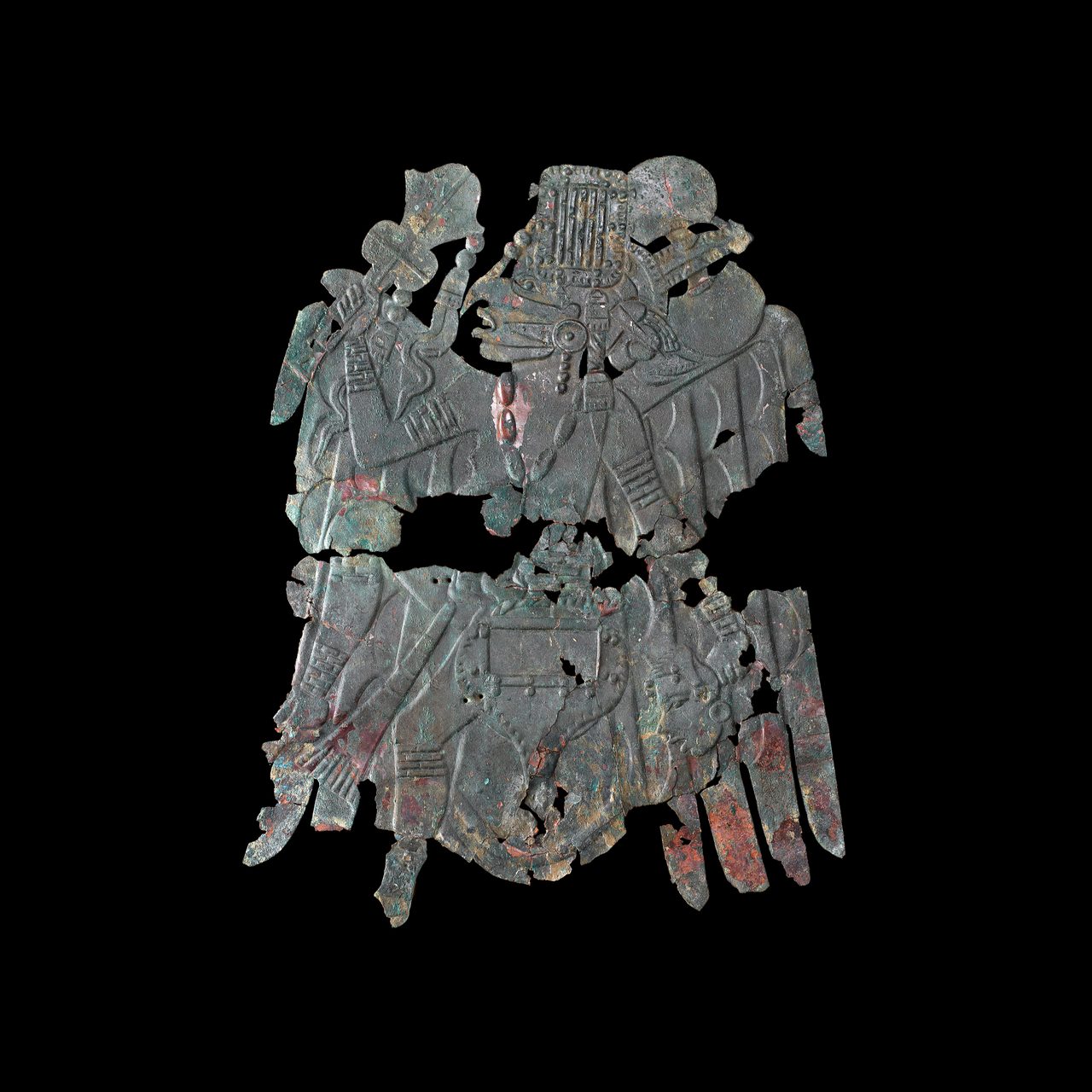
One caution about the most famous objects in that tradition, because they are easy to get wrong. The pair of copper repousse Birdman plates known as the Rogan plates, held by the Smithsonian's National Museum of Natural History, were recovered at the Etowah site in Bartow County, Georgia. They were not excavated at Cahokia. They are attributed on stylistic grounds to a Cahokia-based workshop tradition, the Greater Braden Style, and that attribution came from independent checking during this article's research pass rather than from our own files. So the plates illustrate the tradition Cahokia is credited with originating and exporting. They are not Cahokian finds, and nothing here should be read as implying otherwise.
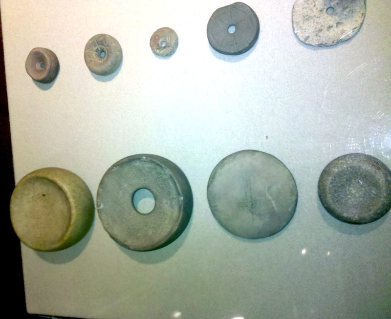
Chunkey, or chungke, was a stone disc game, and our files carry it as far more than recreation. Ethnographic and archaeological evidence, including thousands of chunkey stones documented by Thomas Emerson at Cahokia and at Mississippian-influenced settlements, suggests it functioned as a mechanism for diplomacy, alliance-building, redistribution of wealth, and cosmological enactment. Chunkey stones have been found hundreds of miles from Cahokia, which suggests the game spread along with Cahokian influence. Hold the tier honestly here. That the stones exist in that quantity and travel that far is not the debatable part. What the game did socially is an interpretation of them, and Tier 2 is where our file puts that interpretation.
The broader Mississippian cultural tradition, roughly 800 to 1600 CE, is defined by flat-topped earthen platform mounds supporting timber structures: temples, chiefs' residences, charnel houses. It spread across the southeastern and midwestern United States, and major sites beyond Cahokia include Moundville in Alabama, Etowah in Georgia, Spiro in Oklahoma, Angel Mounds in Indiana, and Winterville in Mississippi. Stratigraphic analysis confirms repeated cycles of mound construction, use, deconstruction, and rebuilding, which suggests the mounds embodied cosmological renewal cycles rather than being built once and left static. That is worth pausing on, because it changes what a mound is. In this tradition a mound is not a finished monument. It is a practice, repeated, and the repetition is legible in the layers.
06Mound 72, and the Argument About Who Was In Charge
Mound 72 is a small ridgetop mound about 850 meters south of Monks Mound, excavated by Melvin Fowler and colleagues from the University of Wisconsin-Milwaukee, with fieldwork running from 1967 to 1971 according to independent checking during this article's research pass. It contained over 270 burials. Among them was a central high-status figure interred on a bed of approximately 20,000 marine shell disc beads arranged in the shape of a raptor, and a nearby mass burial including over 50 young women who appear to have been sacrificed. One of our files gives a more granular count for a specific mass grave inside the mound: 53 sacrificed women and 4 headless and handless men. Other burials held caches of finely worked arrowheads, some with material or stylistic ties to Oklahoma, Tennessee and Wisconsin, along with mica and copper artifacts. Those are the excavated facts, and all three of our files report them consistently at Tier 1. What they mean about power at Cahokia is the next claim, and it sits one tier down, on purpose.
Whether Cahokia constituted a true political state or a complex chiefdom is still argued. Timothy Pauketat argues for centralized political authority approaching statehood, citing the rapid, planned construction of the city center, craft specialization, and the Mound 72 mass burial as evidence of coercive power. George Milner, of Pennsylvania State University, counters that Cahokia lacks the hallmarks of statehood: no writing system, no standing army, no bureaucratic administration, no evidence of taxation. He classifies it as a complex chiefdom, and he separately argues that Cahokia's population has been inflated, proposing a lower peak of 5,000 to 8,000 residents based on residential-structure density analysis, well below the 10,000 to 20,000 and higher figures most other cited scholars use. Susan Alt has argued something different again, that Cahokia's influence over outlying communities was negotiated and less coercive than Pauketat's centralized model implies. Our files record the debate as genuinely unresolved, and note that it turns partly on a definitional question about what counts as a state at all. This article does not settle it. A file that handed you a winner here would be telling you something the evidence has not established, and the honest position is that a bed of 20,000 shell beads and 53 dead women in one grave is compatible with more than one political arrangement.
| The Position | The Case Made For It | Where Our Files Put It |
|---|---|---|
| Timothy Pauketat: a state, or close to one | Centralized political authority approaching statehood, argued from the rapid and planned construction of the city center, craft specialization, and the Mound 72 mass burial as evidence of coercive power | Tier 2. Credible and contested |
| George Milner: a complex chiefdom | Cahokia lacks the hallmarks of statehood: no writing system, no standing army, no bureaucratic administration, no evidence of taxation. Milner also argues the population has been inflated, proposing a peak of 5,000 to 8,000 from residential-structure density analysis | Tier 2. Credible and contested |
| Susan Alt: negotiated influence | Cahokia's influence over outlying communities was negotiated, and less coercive than Pauketat's centralized model implies | Tier 2. Credible and contested |
| What the argument turns on | Partly the evidence, and partly a definitional question about what counts as a state at all | Recorded as genuinely unresolved, and left unresolved here |
07The Ending, and a Date Our Own Files Do Not Share
By some point in the 1300s, Cahokia was largely abandoned. The proposed causes are several, and our files do not rank them: environmental degradation, including the deforestation and stream sedimentation documented by William Woods and George Holley; the onset of the Little Ice Age; political instability; warfare, with a palisade wall enclosing roughly 120 hectares of the central precinct constructed around 1175 CE; and social disintegration. The best-sourced claim in the whole decline debate is a 2019 study. A.J. White and colleagues, publishing in the Proceedings of the National Academy of Sciences, used fecal stanol analysis of Horseshoe Lake sediments to track population fluctuations, and found that depopulation was gradual rather than sudden, and that it began before a major Mississippi River flood in 1200 CE. That points toward internal political causes contributing ahead of, rather than solely in reaction to, a single environmental catastrophe. No single cause has been definitively established. Our files' own conclusion is that the decline was almost certainly multi-causal, and this article's conclusion is the same.
Now the part this article will not smooth over. Our three files do not agree on when largely abandoned happened, and the disagreement is not a range. W_4_04 and W_4_17 both say by 1350 CE. D_1_17 says by 1400 CE. Two of the three, W_4_04 and W_4_17, cite the same White and colleagues 2019 study as their evidence for that date, which means this is not two studies disagreeing; it is one study being read and reported differently inside our own library, with a third file landing on a different year again. It is also worth noting what that study does and does not do. Its own contribution is the shape of the decline curve, gradual against sudden, measured against the 1200 CE flood. It does not hand anyone a single hard end date. So this article states the thing that is actually supported: Cahokia emptied out across the mid-to-late 1300s, and by some readings the process ran into the early 1400s. Printing either year clean would look more authoritative and would be less true. The inconsistency is logged for a future corpus pass.
| Proposed Cause | What Our Files Record |
|---|---|
| Environmental Degradation | Deforestation and stream sedimentation, documented by William Woods and George Holley |
| Climate | The onset of the Little Ice Age |
| Politics | Political instability and social disintegration |
| Warfare | A palisade wall enclosing roughly 120 hectares of the central precinct, constructed around 1175 CE |
| The Shape of the Curve | A.J. White and colleagues (2019) tracked population through fecal stanols in Horseshoe Lake sediments and found depopulation gradual rather than sudden, beginning before a major Mississippi River flood in 1200 CE |
| The Standing Verdict | No single cause has been definitively established. The decline was almost certainly multi-causal |
| The End Date | 1350 CE in two of our files, 1400 CE in the third, all three citing the same 2019 study. This article uses the mid-to-late 1300s, with some readings running into the early 1400s |
08After Cahokia
The first European eyewitness descriptions of functioning Mississippian polities come from Hernando de Soto's expedition, which traversed the southeastern United States from 1539 to 1543, well after Cahokia itself had emptied. Measured against the abandonment dates in section 07, de Soto's party arrives roughly 140 to 190 years too late to have seen the city working. What the chronicles record instead is the wider tradition still running. Garcilaso de la Vega, writing in 1605, Rodrigo Rangel in the 1540s, and the anonymous Gentleman of Elvas in 1557 describe densely populated town centers, paramount chiefs carried on litters, harvest-storage granaries, and large-scale warfare. Charles Hudson reconstructed the expedition's route in 1997, identifying contact with the chiefdoms of Cofitachequi, Coosa and Tascaluza, among others. By the time of the next sustained European contact, French and English in the late 17th century, most Mississippian polities had collapsed, likely due to epidemic disease introduced by de Soto's party. So the tradition Cahokia belonged to outlived the city itself, and when it ended, it ended under a cause that appears nowhere in the list proposed for Cahokia's own decline.
One more thing belongs in a file about a lost city, because it is the part the phrase lost city quietly gets wrong. Many southeastern tribal nations, including the Chickasaw, Choctaw, Muscogee (Creek), Cherokee and Osage, have ancestral connections to Mississippian sites, and were forcibly removed from the region during the 1830s Trail of Tears. The Native American Graves Protection and Repatriation Act, NAGPRA, passed in 1990, has prompted repatriation of some Mississippian-era human remains and sacred objects, and our file records that tension persists between archaeological research interests and tribal sovereignty over ancestral cultural property. That tension is documented in the corpus file's own counter-arguments section, which is where a research file is supposed to keep the thing that complicates it.
09What Is Still Proposed, and What Is Closed
Certain Cahokian features, platform mounds, human sacrifice, a planned city layout around a central plaza, and the possible presence of cacao, have led some researchers to propose direct Mesoamerican influence. One strand of that is a real residue finding: Patricia Crown and colleagues reported chocolate, cacao, Theobroma cacao, residues in Cahokian pottery in 2012, and cacao does not grow north of the Gulf Coast, so its presence supports a trade connection reaching that far. Cahokia flint-clay figurines also show stylistic parallels with Mesoamerican traditions. What is not established is the step from contact to influence. No unambiguous Mesoamerican artifacts have been found at Cahokia itself, and the transmission pathway, direct contact against indirect diffusion through intermediaries, remains undemonstrated. John Kelly, in one of our files, considers indirect diffusion possible but unproven. All three of our files place this at Tier 3, which is a piece of unanimity in a cluster that disagrees about a good deal else.
Some researchers propose that Cahokia's layout was a deliberate map of the cosmos: an Upper World in Monks Mound, a Middle World in the Grand Plaza, and a Lower World in the Mound 72 burials, reflecting widespread Mississippian cosmology. It is an elegant reading, and it is not baseless, since a three-part universe is precisely what Reilly and Garber read out of the Southeastern Ceremonial Complex in section 05. Our file's own limit on it is the honest one: direct evidence of intentional cosmographic planning at the full city scale is limited. That is where this article leaves it.
Several Indigenous oral traditions from the Southeast and Midwest contain references to a great city, a powerful ancient alliance, or a catastrophic dispersal event, and some researchers propose that these may encode memories of Cahokia's rise and fall. The Dhegihan Siouan migration narratives and certain Osage traditions are the named candidates in our file. A direct, confirmed connection to Cahokia specifically is unestablished. Tier 3 here means proposed and unconfirmed, which is not the same as dismissed, and the distinction matters more than usual in a case where the alternative source of testimony, a written record, does not exist at all.
Researchers have proposed that Monks Mound and other Cahokian structures align with significant stellar risings, particularly stars of the constellation Orion and the Milky Way, beyond the well-documented Woodhenge solar alignments. Our file is blunt about the state of that work: these claims have not been rigorously tested with the same precision applied to Woodhenge, and they remain unverified in peer-reviewed literature. This is the place to read the difference between a Tier 1 alignment and a Tier 3 alignment on one site carefully. Woodhenge's solar alignments were excavated, reconstructed from the original postholes, and are observed publicly twice a year. The stellar claims are thinly studied. Same site, same sky, very different evidence.
No. The mounds were not built by a lost, culturally advanced non-Indigenous race. That claim, the 19th-century Mound Builder myth, variously identified those builders as Israelites, Vikings, Welsh or Atlanteans, supposedly displaced or exterminated by the ancestors of contemporary Native peoples. Cyrus Thomas of the Smithsonian's Bureau of Ethnology definitively refuted it in his 1894 report, the Bureau's 12th Annual Report, demonstrating through systematic excavation that the mounds were built by the ancestors of historically known Indigenous peoples. And the myth's function is part of the record rather than a modern gloss on it: our files state that it served a specific political function, justifying Indian removal policy by denying Indigenous peoples credit for their own monumental heritage. All three of our files carry this claim and all three place it at Tier 4, which our research pass records as the strongest possible cross-file agreement on a debunking in this cluster.
No. Claims that Cahokia's scale or alignment required extraterrestrial assistance have no evidentiary basis. The engineering is genuinely impressive at scale and it is fully explicable through organized human labor, as experimental archaeology projects have demonstrated. It is worth setting the two Tier 4 claims side by side, because they are the same move a century apart. Both start from a monument, both conclude that the people whose ancestors built it could not have, and both then supply a more acceptable builder. The 1894 answer to the first one works on the second one too: excavate, and the builders are in the ground.
Fast Facts
- The Site
- Near present-day Collinsville, Illinois, adjacent to East St. Louis. The largest pre-Columbian settlement north of Mexico, approximately 6 square miles, about 16 square kilometers, designated a UNESCO World Heritage Site in 1982
- Peak Population (Tier 1)
- 10,000 to 20,000 in the city proper at the zenith, roughly 1050 to 1200 CE, and up to about 40,000 counting satellite communities within a roughly 50 km radius. Comparable in population to medieval London, whose own figure circa 1100 CE checks out at roughly 10,000 to 15,000
- The Counter-Estimate (Tier 2)
- George Milner argues the population has been inflated and proposes a lower peak of 5,000 to 8,000, from residential-structure density analysis
- Held the Record
- The largest city in what is now the United States until Philadelphia surpassed it in population in the late 18th century, more than 500 years later
- Monks Mound
- The largest pre-Columbian earthwork north of Mexico. Approximately 100 feet, 30 to 30.5 m, tall in four terraces, on a base of roughly 955 by 775 feet, 291 by 236 m, covering about 14 to 15 acres. Built in stages between approximately 900 and 1200 CE
- The Correction
- Our primary file gives the base width as 650 feet. Both secondary files give 236 m, approximately 775 feet, and independent checking agrees on 955 by 775 feet as the standardized 1988 measurement. This article uses 775 feet
- The Earth Moved
- An estimated 22 million cubic feet, roughly 622,000 to 623,000 cubic meters, carried by hand in woven baskets, without draft animals or wheeled vehicles
- The Engineering
- Different clay types deliberately layered to manage drainage and structural stability, which contradicts the earlier assumption of simple, undifferentiated earthen piling
- The Grand Plaza
- Approximately 19 hectares, roughly 47 acres, one of the largest public spaces in pre-Columbian North America, deliberately engineered with layers of colored clay fill (Dalan and colleagues, 2003)
- Woodhenge
- At least five successive timber circles between approximately 900 and 1100 CE, red cedar posts marking solstice and equinox sunrise alignments from a central observation post. The largest of the reconstructed circles held 48 posts at approximately 128 m across; one was rebuilt in 1985 on the original excavated postholes and hosts public sunrise observations to this day
- Mound 72
- Over 270 burials in a small ridgetop mound about 850 m south of Monks Mound, including a high-status figure on approximately 20,000 marine shell disc beads arranged as a raptor, and a mass burial including over 50 young women who appear to have been sacrificed
- The Trade
- Over 1,500 km of reach: Gulf marine shell, Great Lakes copper from Isle Royale and the Keweenaw Peninsula, Missouri galena, Midwest chert, and Ramey Incised pottery distributed outward across the Mississippian world
- The Black Drink (Tier 2)
- Caffeine from Ilex vomitoria, yaupon holly, confirmed in Cahokian beaker ceramics by Crown and colleagues in 2012. The plant's natural coastal range lies far south of the site
- The Diet
- Maize supplying 40 to 65 percent of dietary calories, from stable isotope analysis of Mississippian burials. Intensive cultivation followed the cold-adapted Northern Flint varieties that emerged after 800 CE
- The Big Bang (Tier 2)
- Pauketat's name for the rapid transformation around 1050 CE, inside roughly a generation. His proposed link to the supernova SN 1054 is suggestive correlation rather than demonstrated causation, and our file says so itself
- What Cahokia Was (Tier 2)
- State or complex chiefdom is genuinely unresolved: Pauketat for centralized authority approaching statehood, Milner for a chiefdom lacking writing, a standing army, bureaucracy or taxation, Alt for negotiated rather than coercive influence
- The Ending
- Largely abandoned at some point in the 1300s. Two of our files say by 1350 CE, the third says by 1400 CE, and the two agreeing on 1350 cite the same 2019 study. This article uses the mid-to-late 1300s, with some readings running into the early 1400s
- The Decline Evidence (Tier 2)
- White and colleagues (2019) found depopulation gradual rather than sudden, beginning before a major Mississippi River flood in 1200 CE. No single cause has been definitively established; the decline was almost certainly multi-causal
- Still Genuinely Open (Tier 3)
- Direct Mesoamerican influence, the city-as-cosmogram reading, oral-tradition links to Cahokia specifically, and the proposed stellar alignments beyond Woodhenge
- The Mound Builder Myth (Tier 4)
- No. Refuted through systematic excavation by Cyrus Thomas of the Smithsonian's Bureau of Ethnology in his 1894 report. The myth served to justify Indian removal policy by denying Indigenous peoples credit for their own monumental heritage
- Extraterrestrial Assistance (Tier 4)
- No. No evidentiary basis. The engineering is fully explicable through organized human labor, as experimental archaeology projects have demonstrated
- The Descendants (Tier 2)
- Chickasaw, Choctaw, Muscogee (Creek), Cherokee and Osage nations have ancestral connections to Mississippian sites and were forcibly removed during the 1830s Trail of Tears. NAGPRA (1990) has prompted repatriations, and tension persists between research interests and tribal sovereignty
- What Is Missing
- No deciphered writing. No name the city gave itself, no ruler named outside archaeological inference, and no first-person account of why it emptied
What Is Settled Here, and What Is Not
Cahokia, near present-day Collinsville, Illinois, was the largest pre-Columbian settlement north of Mexico: approximately 6 square miles, about 16 square kilometers, a core ceremonial precinct ringed by residential neighborhoods, and a UNESCO World Heritage Site since 1982. Population estimates at its zenith, roughly 1050 to 1200 CE, run from 10,000 to 20,000 in the city proper, and up to about 40,000 counting satellite communities within a roughly 50 km radius. That makes it comparable in population to medieval London, and the honest form of the comparison is comparable to rather than definitively larger than, because both numbers carry real uncertainty. It remained the largest city in what is now the United States until Philadelphia surpassed it in the late 18th century, more than 500 years later.
Monks Mound is the largest pre-Columbian earthwork north of Mexico: approximately 100 feet tall in four terraces, on a base of roughly 955 by 775 feet, covering about 14 to 15 acres, built in stages between approximately 900 and 1200 CE from an estimated 22 million cubic feet of earth carried by hand in woven baskets, without draft animals or wheeled vehicles. Soil analyses show deliberately layered clay types managing drainage and structural stability. South of it the Grand Plaza, approximately 19 hectares, was engineered flat with layers of colored clay fill. West of it, at least five successive Woodhenge circles between approximately 900 and 1100 CE marked solstice and equinox sunrises with red cedar posts, and one reconstructed circle still hosts public sunrise observations. One correction is carried in the body rather than applied quietly: our primary file's base width of 650 feet does not survive checking, since both secondary files give 236 m, approximately 775 feet, and independent checking converges on 955 by 775 feet. This article uses 775.
Cahokia's trade connections span over 1,500 km, traceable through Gulf marine shell, Great Lakes copper from Isle Royale and the Keweenaw Peninsula, Missouri galena, and Midwest chert recovered at the site, with Ramey Incised pottery distributed outward. Maize supplied 40 to 65 percent of dietary calories, measured by stable isotope analysis of Mississippian burials, and intensive cultivation followed the cold-adapted Northern Flint varieties that emerged after 800 CE. Mound 72, about 850 m south of Monks Mound, held over 270 burials, including a high-status figure on approximately 20,000 marine shell disc beads arranged as a raptor, and a mass burial including over 50 young women who appear to have been sacrificed. The Southeastern Ceremonial Complex iconography and the wider Mississippian platform-mound tradition, roughly 800 to 1600 CE, are Tier 1 as well. These are objects and bones rather than inferences about them, which is why they sit here while the readings of what they meant sit lower.
Whether Cahokia was a state or a complex chiefdom is unresolved. Pauketat argues for centralized political authority approaching statehood, from the rapid, planned construction of the center, craft specialization, and the Mound 72 mass burial as evidence of coercive power. Milner argues it lacks the hallmarks of statehood, no writing system, no standing army, no bureaucratic administration, no evidence of taxation, and separately argues the population has been inflated, proposing a lower peak of 5,000 to 8,000 from residential-structure density analysis. Alt argues the influence over outlying communities was negotiated rather than coercive. Our files record the debate as genuinely unresolved and note that it turns partly on what counts as a state at all. Both population figures are carried here at their own tiers rather than averaged, and no winner is crowned.
The rapid transformation around 1050 CE that Pauketat calls the Big Bang is credible; his proposed link to the supernova SN 1054 is explicitly suggestive correlation rather than demonstrated causation, and our file says so itself. Caffeine from Ilex vomitoria, the ceremonial Black Drink, was confirmed in Cahokian beaker ceramics by Crown and colleagues in 2012, well north of the plant's natural range, with the tier reflecting the ritual interpretation rather than the residue chemistry. Chunkey, documented in thousands of stones by Thomas Emerson and found hundreds of miles away, is credibly read as diplomacy, alliance-building, redistribution and cosmological enactment. And the decline: environmental degradation, the Little Ice Age, political instability, warfare with a palisade around roughly 120 hectares built about 1175 CE, and social disintegration are all proposed, with White and colleagues (2019) finding depopulation gradual rather than sudden and beginning before a major Mississippi River flood in 1200 CE. No single cause is established, and the decline was almost certainly multi-causal, with the city largely emptied across the mid-to-late 1300s and, by some readings, into the early 1400s.
Many southeastern tribal nations, including the Chickasaw, Choctaw, Muscogee (Creek), Cherokee and Osage, have ancestral connections to Mississippian sites and were forcibly removed from the region during the 1830s Trail of Tears. NAGPRA, passed in 1990, has prompted repatriation of some Mississippian-era human remains and sacred objects, and our file records that tension persists between archaeological research interests and tribal sovereignty over ancestral cultural property. That is carried here because it sits in the corpus file's own counter-arguments section, and because a wing about lost worlds should be careful with the word lost.
Direct Mesoamerican influence is proposed from platform mounds, human sacrifice, a plaza-centered plan and the cacao residues reported by Crown and colleagues in 2012, but no unambiguous Mesoamerican artifacts have been found at Cahokia itself and the transmission pathway remains undemonstrated; John Kelly considers indirect diffusion possible but unproven. The reading of the city as a deliberate cosmogram, Upper World in Monks Mound, Middle World in the Grand Plaza, Lower World in the Mound 72 burials, is architecturally suggestive, with direct evidence of intentional planning at the full city scale limited. Indigenous oral traditions from the Southeast and Midwest, including Dhegihan Siouan migration narratives and certain Osage traditions, may encode memories of Cahokia's rise and fall, but a direct confirmed connection to Cahokia specifically is unestablished. And proposed stellar alignments toward Orion and the Milky Way have not been rigorously tested with the precision applied to Woodhenge, and remain unverified in peer-reviewed literature. Speculative here means proposed and unconfirmed, not refuted.
No. The 19th-century Mound Builder myth, which attributed the mounds to a lost, culturally advanced non-Indigenous race variously identified as Israelites, Vikings, Welsh or Atlanteans supposedly displaced or exterminated by the ancestors of contemporary Native peoples, was definitively refuted by Cyrus Thomas of the Smithsonian's Bureau of Ethnology in his 1894 report, which demonstrated through systematic excavation that the mounds were built by the ancestors of historically known Indigenous peoples. The myth served a specific political function: justifying Indian removal policy by denying Indigenous peoples credit for their own monumental heritage. All three of our files carry this at Tier 4.
No. Claims that Cahokia's scale or alignment required extraterrestrial assistance have no evidentiary basis. The engineering is genuinely impressive at scale and fully explicable through organized human labor, as experimental archaeology projects have demonstrated. This is not a question being held politely open. It is a closed one, and what closed it is the same thing that closed the first: excavation.
So here is the honest shape of the file. Cahokia is real, excavated, mapped and protected, and its scale genuinely stands beside contemporary cities of the Old World. What is missing is not the city. It is the city's own voice. Its people left no writing anyone has deciphered, which means the name Cahokia is one applied later, the rulers are archaeological inferences rather than people with names, and there is no first-person account of the leaving and never will be. Everything genuinely in dispute here, whether this was a state or a chiefdom, whether the decline had one cause or five, whether the city was empty by 1350 or by 1400, is a live scholarly argument conducted in the open with named people on both sides. None of it is a cover-up, and none of it is a gap that fringe explanation gets to occupy: all three of our files close off the lost race, and our primary file closes off the visitors too. Which leaves the question the site actually poses, and it is not who built it, because Cyrus Thomas answered that in 1894 and every excavation since has confirmed it. It is this. What does a civilization leave behind when it leaves no sentences? Cahokia's answer is 22 million cubic feet of earth, a plaza made flat by hand, a ring of cedar posts aimed at the sunrise, and over 270 burials in one small mound. That is a great deal to be handed, and it is not an explanation. How much of what any unwritten people meant is simply unrecoverable, and how comfortable should any of us be filling that space in?
Sources & further reading
Everything above is drawn from our research library on Theories of Anything: principally the Cahokia and Mississippian culture file W_4_04, whose own header rates it Tier 1 to 2 with high confidence and a source confidence of 4 out of 5, and secondarily two further files read in full during this article's research pass, W_4_17 (Mississippian Culture and Mound-Builder Networks) and D_1_17 (Cahokia and Monks Mound). Between them the three files carry 44 bibliography entries, 18, 14 and 12, which is the figure in the source count above. Two things in this article depart from those files, and both are stated in the body rather than applied quietly. First, Monks Mound's base width. W_4_04 gives the base as over 950 feet long by 650 feet wide, while W_4_17 and D_1_17 both independently give 291 by 236 meters, and 236 meters is approximately 775 feet. Independent checking during the research pass converged on 955 by 775 feet as the standardized 1988 measurement, so this article uses 775 feet and says so in section 02. Second, the abandonment date. W_4_04 and W_4_17 both say Cahokia was largely abandoned by 1350 CE; D_1_17 says by 1400 CE. Two of the three, W_4_04 and W_4_17, cite the same White and colleagues 2019 study for their shared 1350 figure, so at least part of this disagreement is one study reported the same way by two files while a third file lands on a different year again, and that study's own contribution is the shape of the decline curve rather than a single end date. Section 07 states both figures and uses a hedged range. Three further details come from independent checking rather than from the files: London's population circa 1100 CE, used to test the medieval London comparison; the 1967 to 1971 fieldwork dates for Fowler's Mound 72 excavation; and the attribution of the Rogan plates to the Cahokia-based Greater Braden Style. Those plates were recovered at the Etowah site in Georgia and not at Cahokia, and section 05 says so explicitly, because a stylistic attribution is not a provenance. Now the housekeeping, which belongs here rather than being passed along quietly. Across the three files, five DOIs were independently checked and found wrong, and four were checked and found correct. The five wrong ones share one defect class: the DOI attached to a book resolves to a published book review rather than to the book itself, though not always a review of that same book. Pauketat's Cahokia: Ancient America's Great City on the Mississippi (2009) carries, identically in all three files, a DOI that resolves to Diana DiPaolo Loren's 2012 review of it in Urban History. Milner's The Cahokia Chiefdom (1998) carries a DOI resolving to Henry T. Wright's review of it in American Antiquity. Dalan and colleagues' Envisioning Cahokia (2003) carries, in two of the three files, a DOI resolving to Thomas E. Emerson's review of it in American Antiquity. Fowler and colleagues' 1999 Mound 72 report carries a DOI resolving to a 1958 review of two entirely different 1957 Fowler publications. And Pauketat's Ancient Cahokia and the Mississippians (2004) carries a DOI resolving to a 2010 review of two books about Hindu law in the Ecclesiastical Law Journal, which is not even topically adjacent. This defect class was named as a known risk pattern before the research pass began, and it is unusually widespread in this cluster: it hit most of the non-journal identifiers and spared only two. Every one of those works is therefore named in this article by title, author and year, and none of them is linked. The four identifiers checked and found correct are all linked below: Crown and colleagues on the Black Drink (2012), White and colleagues on the fecal stanol record (2019), Brown's Birdman chapter (2007), and Pauketat's An Archaeology of the Cosmos (2013). No wrong identifier has been carried forward, and none has been replaced with a guess. Three smaller defects are logged rather than corrected here. One ISBN is wrong twice over: W_4_17 and D_1_17 give different ISBNs for the same book, Milner's The Moundbuilders (Thames and Hudson, 2004), and neither matches the real ISBN-13 found by independent checking. One journal attribution is wrong: W_4_17 cites John H. Blitz's 1999 article on Mississippian chiefdoms and the fission-fusion process as appearing in World Archaeology at volume 31.3, while independent checking places it in American Antiquity, volume 64, at the same page range, and a lookup of the DOI implied by the World Archaeology attribution returned no registered record. That citation was not load-bearing for any claim in this article. And one citation is ambiguous rather than wrong: W_4_04 cites Warren Wittry's An American Woodhenge as a 1964 piece in the Cranbrook Institute of Science Newsletter, while D_1_17 cites the same title as a 1969 article in Explorations into Cahokia Archaeology. Those may genuinely be two publications, a short announcement followed by a fuller treatment, which is a common academic pattern, or one may be a garbled duplicate of the other. This article cites the underlying discovery without committing to either bibliographic identity. The cross-references have their own problems. W_4_17 points at D_1_17 under a folder and filename that do not exist, though the document ID itself resolves correctly once the real path is found. D_1_17's own header and footer disagree with each other about which document ID means Poverty Point, and both candidate IDs turn out to belong to unrelated real documents, one on Serpent Mound and one on the Sanchi Stupa. W_4_17's footer points at a societal-collapse document under a misspelled folder, and the ID it gives resolves instead to a Younger Dryas boundary geochemistry file, the same class of topically-mismatched cross-reference found on another file during this build session. None of those mismatched targets was used as a source for anything above, and W_4_04's own header cross-reference to Serpent Mound is, by contrast, correctly labeled and resolves cleanly. All of this is collected for a future corpus pass, not corrected in the corpus here. The files' other named sources include Emerson's Cahokia and the Archaeology of Power (1997), Reilly and Garber's edited volume Ancient Objects and Sacred Realms (2007), Fritz's Feeding Cahokia (2019), Hudson's Knights of Spain, Warriors of the Sun (1997), Milner's The Moundbuilders (2004), and Cyrus Thomas's Report on the Mound Explorations of the Bureau of Ethnology (1894). Open the full files to check the sourcing and go deeper.
Image credits
- Monks Mound, Cahokia site, Illinois QuartierLatin1968, via Wikimedia Commons (CC BY-SA 3.0). CC BY-SA 3.0 Source.
- View from Monks Mound's summit toward St. Louis and the Woodhenge field Caroline (Cmgabe), via Wikimedia Commons (CC BY-SA 3.0). CC BY-SA 3.0 Source.
- Monks Mound, terraced profile Skubasteve834, via Wikimedia Commons (CC BY-SA 3.0). CC BY-SA 3.0 Source.
- Woodhenge's reconstructed central post, Cahokia QuartierLatin1968, via Wikimedia Commons (CC BY-SA 3.0). CC BY-SA 3.0 Source.
- Rogan plate, copper repousse Birdman figure (excavated at Etowah, Georgia) Donald E. Hurlbert, Smithsonian Institution, via Wikimedia Commons (CC BY-SA 4.0). CC BY-SA 4.0 Source.
- Chunkey stone discoidals (found in Ohio) Herb Roe, via Wikimedia Commons (CC BY-SA 3.0). CC BY-SA 3.0 Source.
- 19th-century illustration of Monks Mound Publisher unresolved between two 19th-century sources, via Wikimedia Commons (Public Domain). Public Domain Source.
- Monks Mound card crop QuartierLatin1968, via Wikimedia Commons (CC BY-SA 3.0). CC BY-SA 3.0


