
Snowball Earth: The Planet That Froze to the Equator
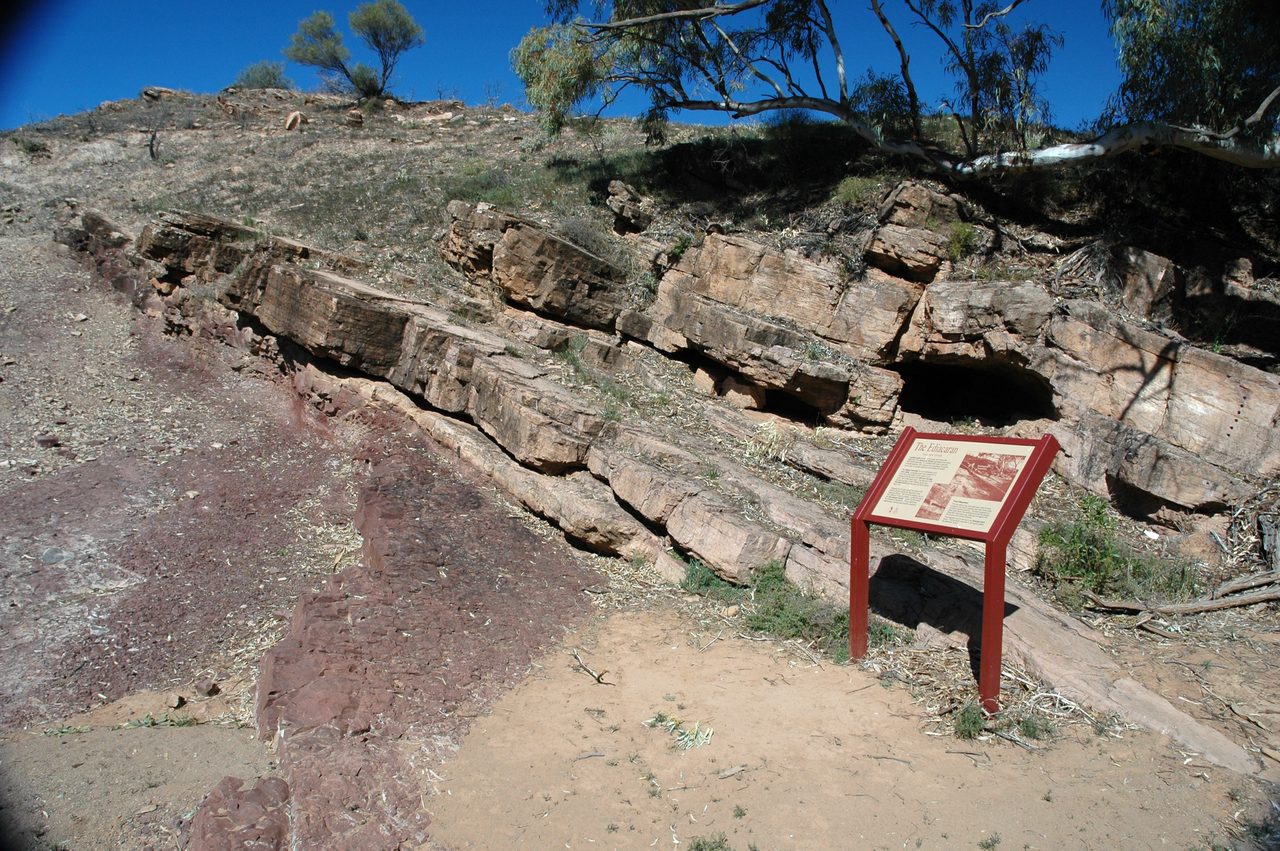
Between roughly 720 and 635 million years ago, glaciers left their deposits on every continent, and palaeomagnetic measurements place several of those deposits within about 10 degrees of the equator. Ice at sea level in the tropics is verified. What is not verified is the picture the name conjures: a planet frozen solid, ocean and all. Our own research file says so in its own counter-arguments section, that the live scientific debate concerns the degree of ice cover rather than whether extreme glaciation occurred, and fifteen years of climate modelling since have moved that debate without closing it. This is the file, claim by claim, each one wearing its evidence, with the rocks carried separately from the model.
This article's title carries two claims, and they do not have the same standing. The first is that ice reached the equator: glacial deposits laid down within about 10 degrees of it, dated, and pinned to that latitude by the magnetism locked into the rock as it formed. That claim is verified, it is recorded on every continent, and nothing in this article disputes it. The second claim is the one most readers will hear inside the word snowball: that the entire ocean surface froze over, pole to pole, a white planet. That claim is a model. It is credible, it is argued by serious people using real physics, and it is not settled.
Our own research file states the shape of the dispute in one sentence, and that sentence is the spine of this whole article: the geological evidence for Cryogenian low-latitude glaciation is robust, and the main scientific debate concerns the degree of ice cover, not whether extreme glaciation occurred. So read the title the first way, ice at the equator, which the rocks support. Hold the second reading, a fully frozen ocean, in the box marked not yet decided, and this article will keep the two apart from here to the end. Let's open the file.
01What the Rocks Actually Show
Start with the part nobody argues about. The Cryogenian period left a sedimentary record on every continent, and it is a very odd one. The oddness is not that there was ice. It is where the ice was.
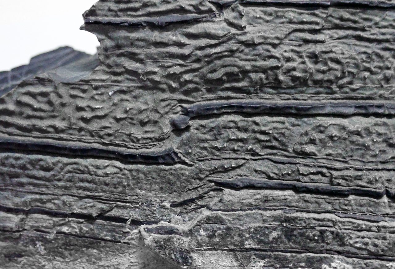
Glacial diamictites, poorly sorted sediments carrying striated clasts, are found on every continent in rocks of Cryogenian age, roughly 720 to 635 million years ago. Diamictite on its own says a glacier passed through. What makes these particular deposits a problem is what palaeomagnetism adds to them: analysis shows that many of them were laid down at tropical palaeolatitudes, under 10 degrees. That is the observation the entire hypothesis was built to explain, and it is the observation this article treats as settled.
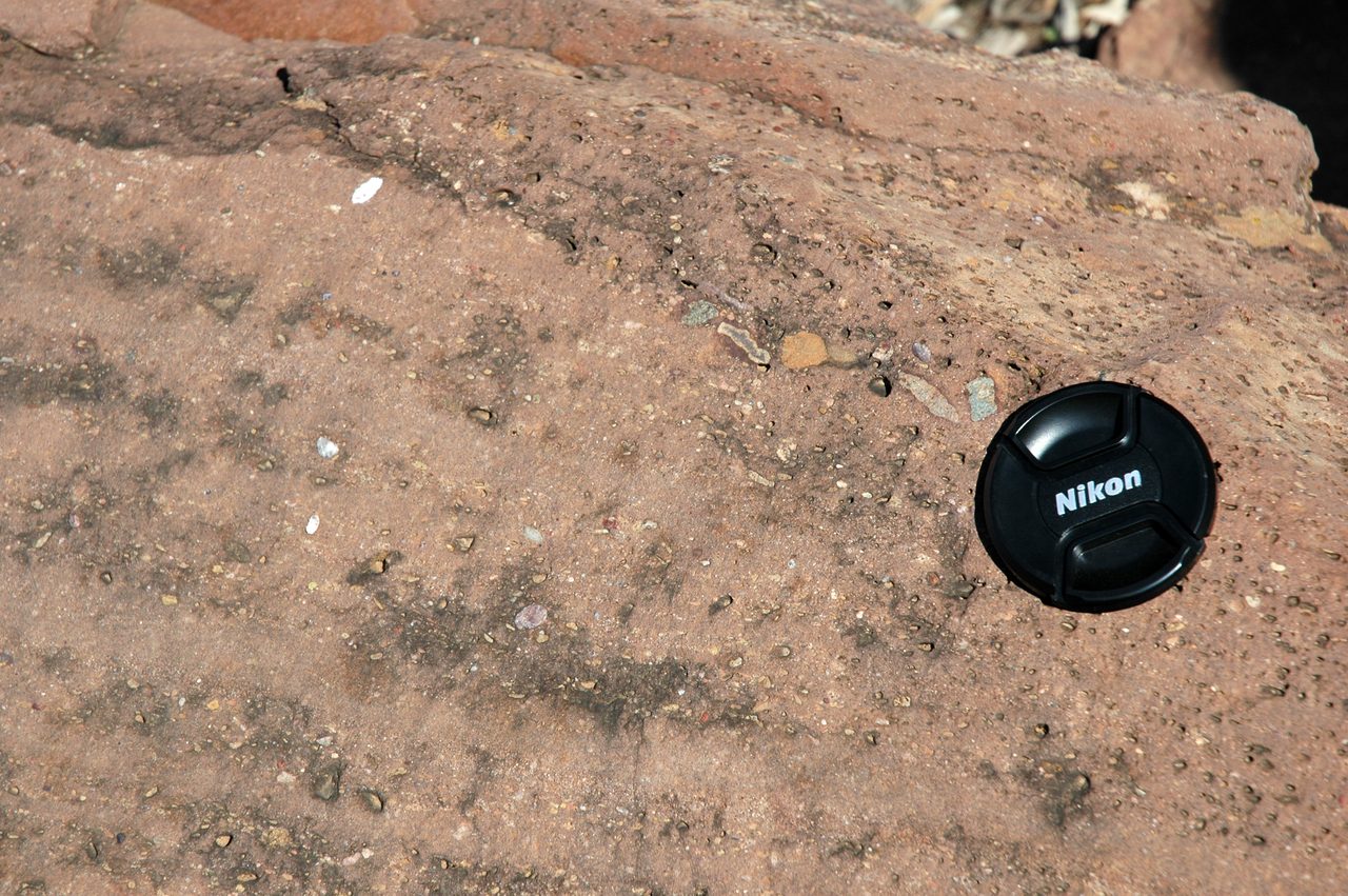
The tightest of those latitude constraints comes from the Elatina Formation of South Australia, a Marinoan-age deposit of roughly 635 million years, which our file credits to Sohl and colleagues in 1999 and to Evans in 2000. The palaeomagnetic work places its glacial deposits at about 10 degrees latitude. One detail is worth naming rather than smoothing: the 1999 study's own title dates the Marinoan deposits at about 600 million years, which was the figure before the radiometric refinement described below. Both numbers are honest at their own dates, and they are not to be blended into a range.
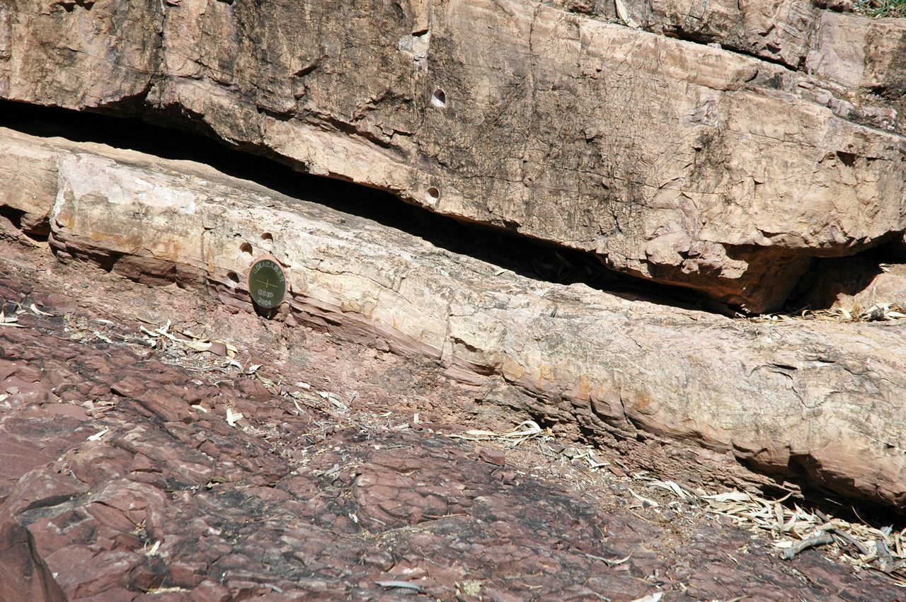
Improved radiometric dating then showed those deposits are not a scatter of unrelated regional ice ages but a global and synchronous phenomenon, which our file names as the primary evidence for pan-global ice cover, citing Rooney and colleagues in 2015 and Macdonald and colleagues in 2010. Rooney's own constraints are a Sturtian glaciation from 717 to 660 million years ago and a Marinoan termination at 635 million years ago, including a direct Re-Os constraint on that termination in Laurentia of 632.3 give or take 5.9 million years. One correction to our own file belongs right here, because this article is built on it: E_2_11's prose calls the Rooney paper a PNAS paper. It is in Geology, volume 43, pages 459 to 462. The file's own bibliography gets this right; only its prose is wrong.
Note carefully what that phrase, primary evidence for pan-global ice cover, does and does not settle. It establishes that the glaciation was global in its distribution, appearing on continent after continent within the same narrow window. That is not the same statement as saying the ocean surface was covered, and the difference between those two statements is the argument this article is about to carry.
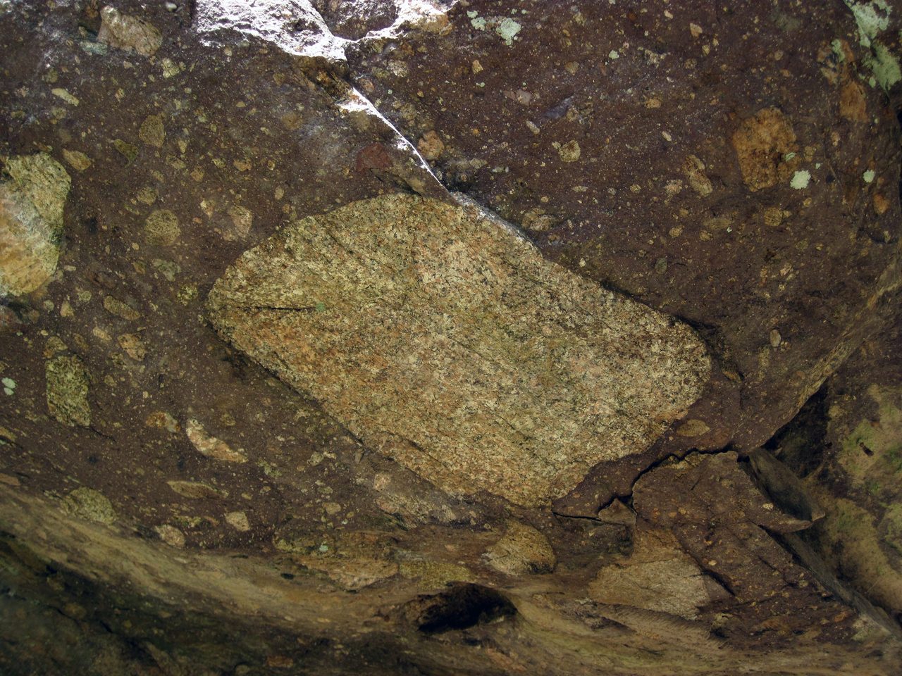
There were at least two of these events, not one, and they were not the same length. The Sturtian glaciation ran from about 717 to about 660 million years ago; the Marinoan from about 650 to 635 million years ago, with the onset date the softest of the four because the termination is constrained far more tightly than the beginning. Hoffman and colleagues, in a 2017 synthesis, open with the geological summary in their own words: grounded ice sheets reached sea level at all latitudes during two long-lived Cryogenian glaciations, which they give as 58 million years and at least 5 million years respectively. The first was enormously longer than the second, and only the second carries a bare lower bound.
| Glaciation | When | How Long | What Constrains It |
|---|---|---|---|
| Sturtian | About 717 to 660 million years ago | 58 million years, as given by Hoffman et al. 2017 | Radiometric dating reported by Rooney et al. 2015 in Geology, with Macdonald et al. 2010 on the calibration |
| Marinoan | About 650 to 635 million years ago; the onset is much the softer of the two dates | At least 5 million years, as given by Hoffman et al. 2017 | Rooney et al. 2015 constrain the termination at 635 million years ago, including a direct Re-Os constraint in Laurentia of 632.3 give or take 5.9 million years; the onset far less tightly |
02The Carbonate Lid, and the Air Above It
The second piece of evidence is not the ice. It is what sits directly on top of the ice deposits, and it is the wrong rock in the wrong place.
Directly overlying the glacial diamictites, on every continent, are cap carbonates: thick sequences of limestone and dolostone, meters to tens of meters, deposited in what look like warm, shallow marine conditions. The transition is abrupt in the rock. A deposit made by a glacier, and immediately above it, without a long weathered interval between, a deposit made by a tropical sea.
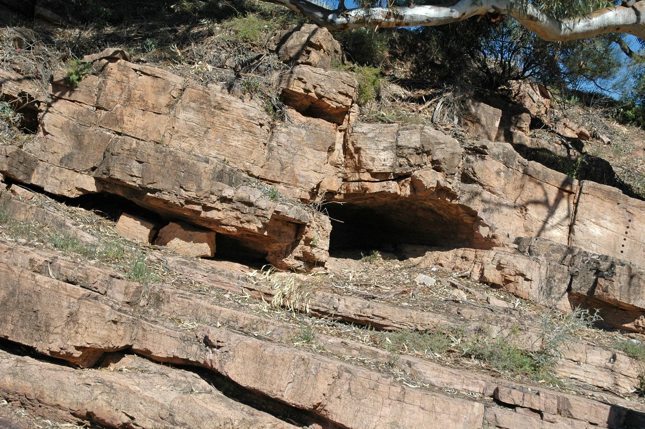
The accepted explanation is a geochemical one, and it is the part of the hypothesis that has held up best. Ice-covered continents remove the silicate weathering that normally draws carbon dioxide back out of the atmosphere, while volcanoes keep venting it. Over millions of years the atmosphere accumulates an enormous carbon dioxide load. When that greenhouse finally overwhelms the ice, the resulting super-greenhouse drives chemical weathering at extraordinary intensity, delivering alkalinity to the ocean and precipitating vast quantities of carbonate. The cap carbonate is the receipt for the thaw.
The number attached to that carbon dioxide load needs care, because the one in circulation is old. Our file gives about 350 times preindustrial values, citing Hoffman and colleagues in 1998, and that is a 1998 estimate. The same lead author's 2017 synthesis states the range differently: current estimates of the carbon dioxide level required to terminate a Cryogenian Snowball run from 0.01 to 0.1 volume mixing ratio, which is 10,000 to 100,000 parts per million. Our own arithmetic, and we label it as ours: 350 times a 280 ppm preindustrial baseline is about 98,000 ppm, which sits at the very top of that published range rather than outside it. The 1998 figure is not refuted. It is the high end of a range that is now quoted with an order of magnitude of spread, and it should never travel without its date attached. One further honesty note: the 2017 abstract also carries a figure in atmospheric-level multiples that our research pass could not confirm, because the text extraction lost a superscript and the publisher page returned an access block, so we do not print it here.
Alongside the cap carbonates, extreme carbon isotope excursions bracket the glacial intervals. Our file lists them with the cap carbonates and the iron formations as one of the otherwise puzzling features of the Cryogenian record that the hypothesis was constructed to account for. The file gives no per-mil values for those excursions, and neither will this article.
03The Iron That Came Back
The third piece of evidence is an absence that ends. Something that had stopped happening on Earth for roughly a billion years started happening again, briefly, in exactly this window.
Banded iron formations, alternating layers of iron-rich and silica-rich sediment, reappeared during the Cryogenian after an absence of roughly one billion years. They had been common in the Archean and the early Proterozoic, when the oceans were anoxic and dissolved iron could travel, and they largely ceased once the atmosphere and oceans oxygenated. Their Cryogenian return is consistent with an ice-covered ocean, where limited photosynthesis and no exchange of gases with the air would leave deep water anoxic and iron-rich, so that deglaciation oxidised the dissolved iron and dropped it out of solution. Consistent with is the file's own wording, and it is the right strength: the return of the iron is a fact, and the step from that fact to a fully covered ocean belongs to the model, not to the rock.
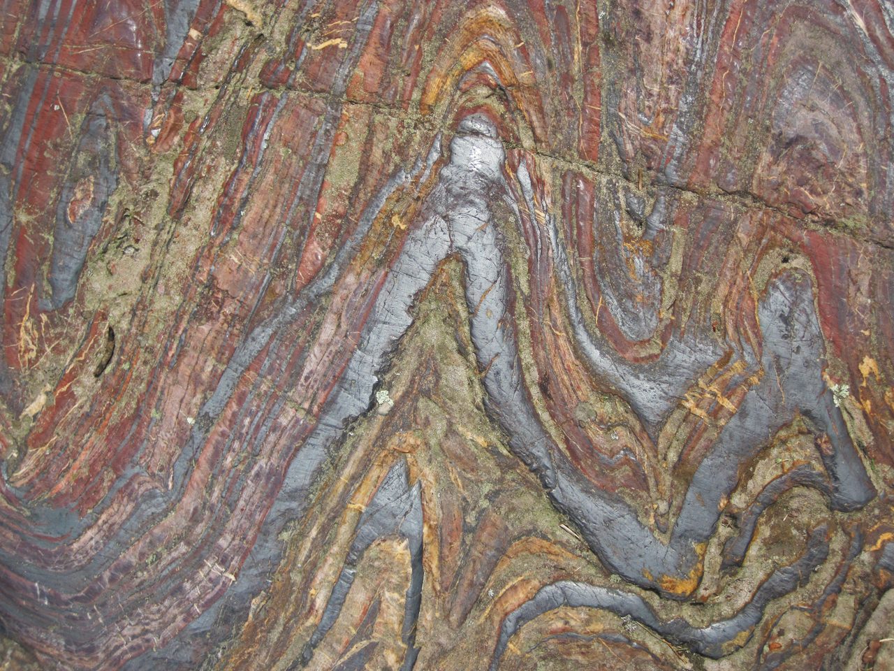
The current literature reads Neoproterozoic iron formation the same way, as evidence for the widespread return of anoxic, iron-rich ocean basins, and it supplies two place names our file lacks. Most Neoproterozoic iron formation is tied to the earlier Sturtian epoch: the Rapitan iron formation of northwestern Canada is the Sturtian example, and the Urucum deposits of Brazil the Marinoan one, and both sit stratigraphically alongside glacial rocks. That gives the claim somewhere real to stand rather than leaving it as a generalisation.
One number in that paragraph should not be sharpened, and the reason is that our own files do not agree on it. E_2_11 attributes the end of banded iron formation deposition to the Great Oxygenation Event, at about 2.4 billion years ago. Our Great Oxygenation Event file, E_2_12, dates the cessation to after about 1.8 billion years ago, with Cryogenian-age iron formations named as the exception. That is roughly 600 million years of daylight between two of our own documents. Both are defensible readings of a drawn-out process, so this article names no single crisp cessation date. While we are here: E_2_11 points its reader to E_2_14 for the Great Oxygenation Event, and E_2_14 is our Deccan Traps file. The oxygenation file is E_2_12, and it is linked below.
04The Argument: Snowball Or Slushball
Everything above is the evidence. Everything from here to the end of section 05 is the model, and the model is where the field divides. The dividing question is narrow and specific: not whether there was extreme glaciation, but how much of the ocean surface the ice actually covered.
The mechanism at the heart of the hypothesis is not in dispute. Ice reflects sunlight, reflected sunlight means less absorbed heat, less absorbed heat means more ice, and more ice means still more reflection. That is the ice-albedo feedback, and it is a genuine runaway: past some threshold it accelerates itself. The physics is standard. What the physics does not settle, on its own, is where the runaway stops.
The hard version, the one Hoffman and colleagues set out in 1998, is that it did not stop until the ocean was gone. On this model the sea surface froze completely, with ice thickness reaching about 1 kilometer globally, and photosynthesis was reduced to whatever could survive in cracks, in patches of thin ice, or in oases near volcanic hot spots. This is the model the word snowball actually names, and it is the model this article's own title will be read as endorsing.
The soft version, Slushball, holds that a thin belt of open ocean, or of thin ice under 10 meters, persisted at the equator through even the deepest glaciation, and that photosynthesis carried on there. Our file credits this to Hyde and colleagues in 2000, whose coupled climate and ice-sheet simulations are the standard citation for it. In our file's own four-tier scheme, this model and the hard one sit at the same tier, with the same status, and the file does not choose between them.
The open-water belt got its modern formal treatment, and its name, in 2011. Abbot, Voigt and Koll described the Jormungand state: a nearly ice-covered Earth that retains a narrow strip of open ocean near the equator, roughly 10 to 15 degrees of latitude wide, held open by the internal dynamics of the water cycle and the ice rather than by an outside rescue. The stabilising mechanism is that net evaporation in the subtropics, combined with the low albedo of snow-free sea ice, weakens the ice-albedo feedback badly enough there to let a low-latitude ice edge sit still. The name is the scientists' own: Jormungand is the serpent of Norse myth that encircles the world and bites its own tail.
A second correction to our own file belongs here, and it is the more serious of the two. E_2_11 cites Abbot and Pierrehumbert 2010 as a source for the Slushball alternative. That paper is Mudball, and it argues close to the opposite: that over the lifetime of a Snowball event, ice dynamics concentrate continental and volcanic dust on the tropical ice surface, lowering the surface albedo enough to permit deglaciation. It is a solution to the problem of how a fully glaciated Earth escapes, so it presupposes the hard state rather than replacing it with an open belt. The identifier in our bibliography points at a real paper that says a real thing; the defect is entirely in the use, which is why no automated check in our chain could catch it. For the waterbelt side, cite Hyde and colleagues in 2000 and Abbot, Voigt and Koll in 2011. Mudball earns its own sentence on its own terms, and it is a good one: the ice got dirty, and that is how the planet thawed.
So the state of the field is not a contest between a theory and its absence. Our file's counter-arguments section puts it exactly, and this is the sentence to carry out of the article: the geological evidence for Cryogenian low-latitude glaciation is robust, and the main scientific debate concerns the degree of ice cover, not whether extreme glaciation occurred.
| Position | The Model | What It Predicts That the Rival Does Not | Its Strongest Support | Where It Stands |
|---|---|---|---|---|
| Hard Snowball | The ocean surface froze completely, with ice thickness reaching about 1 kilometer globally (Hoffman et al. 1998) | No open water anywhere. Sea ice thick enough to flow as a sea glacier toward the equator; a reversed mean tropical circulation producing an equatorial desert; survival forced onto cracks, thin ice, volcanic oases or the ice surface itself. Hoffman 2025 states the extreme form: oceans 99.9 percent covered by light-blocking ice shelves | The synchronous global distribution of low-latitude glacial deposits; the cap carbonates; the Cryogenian return of banded iron formations, which the hard side reads as requiring an ocean cut off from the air; and, since 2022, two climate-model results that narrow the case for a stable open belt | Gaining ground in the modelling literature. Hoerner and Voigt 2024 found stable waterbelt states vanish under more physical sea-ice thermodynamics |
| Slushball, or the waterbelt | A narrow belt of open ocean, or of thin ice under 10 meters, survived at the equator throughout (Hyde et al. 2000; formalised as the Jormungand state by Abbot, Voigt and Koll 2011) | A strip of open water roughly 10 to 15 degrees of latitude wide near the equator, sustained by subtropical net evaporation plus the low albedo of snow-free sea ice. Continuous open-water photosynthesis, and therefore a refugium that needs no exotic mechanism. Dynamic glaciers delivering sediment into an open sea | Allen and Etienne 2008, a sedimentological argument that Cryogenian glacial rocks record dynamic glaciers and ice streams feeding sediment to open ocean throughout the glacial cycle. It comes from rocks rather than from a model, it is unretracted, and it is heavily cited | Its climate-model support has been narrowed since 2022, and the modelling results since do not address its sedimentological objection. Braun et al. 2022 found the waterbelt's existence turns on cloud physics that remain uncertain |
| What both sides accept | Extreme, genuinely low-latitude, globally distributed glaciation happened at least twice in the Cryogenian | Not applicable: this is the ground neither side contests | Glacial diamictites on every continent with palaeomagnetic constraints under 10 degrees; cap carbonates lying directly on them; the return of banded iron formations; carbon isotope excursions bracketing the intervals | Settled. Our own file says so in as many words, and it is why the title of this article survives on its first reading |
05What Has Happened to the Argument Since 2010
Our file's model section stops around 2010, and the fifteen years since have not been quiet. Four results matter, they do not point the same way, and the honest summary at the end of them is not a winner.
In 2022 Braun, Hoerner, Voigt and Pinto published in Nature Geoscience under a title that states its own finding: the ice-free tropical waterbelt for Snowball Earth events is questioned by uncertain clouds. Whether an open belt can exist at all turns on cloud physics the models do not yet pin down. We carry that paper's title claim and nothing beyond it, because the title is the part our research pass was able to verify directly; the publisher page redirected to an authentication wall.
In 2024 Hoerner and Voigt published an open-access result in Earth System Dynamics that goes at the waterbelt harder, and their own framing of the question is scrupulous: there is an ongoing debate about how the runaway feedback stopped, with fully ice-covered oceans or with a narrow strip of open water around the Equator. What they found is that the answer depends on which sea-ice physics the model runs. Stable waterbelt states appear with the simplified zero-layer sea-ice model and do not appear with the more physical three-layer model; under the three-layer model the simulations either stay ice-free or fall into a Snowball state in less than 250 years, and the waterbelt hysteresis disappears entirely. Their own conclusion is that robust waterbelt states are only possible if other stabilising mechanisms, ocean heat transport in particular, are also at work. That is a real blow to the Slushball side, delivered by a result the side itself would have to answer.
In 2025 Hoffman, the hypothesis's principal architect, stated the hard position in its most extreme published form. His PNAS paper opens with the claim that geological observations informed by climate dynamics imply the oceans were 99.9 percent covered by light-blocking ice shelves during two discrete, self-reversing Snowball Earth epochs spanning a combined 60 to 70 million years of the Cryogenian. That figure belongs to Hoffman 2025 by name. It is not a consensus number, and it should never be quoted as one.
And against all of that stands a paper from 2008 that nobody has withdrawn. Allen and Etienne, in Nature Geoscience, made a sedimentological challenge to Snowball Earth: the rocks deposited during the Cryogenian glacial intervals indicate that dynamic glaciers and ice streams went on delivering large volumes of sediment to open ocean throughout the glacial cycle, which means some ocean was not covered. We paraphrase rather than quote, because our research pass resolved the paper's identifier exactly but could not open its full text or a verbatim abstract, and a secondary summary must not be dressed as an author's own words. The point stands on its own weight regardless: it is an argument from sediment, not from simulation, and a modelling result is not well placed to dismiss it.
So the honest position in 2026 is this. The hard-Snowball side has gained ground in the climate-modelling literature, and gained it on the merits. The sedimentological objection to it has not been withdrawn, and the modelling results since do not address it. Nobody has closed the question, and this article names no winner because the field has not.
06How Anything Survived, Which Is Not a Solved Problem
There is a question underneath the model argument that usually gets treated as its by-product, and it deserves better. Photosynthetic life existed before the Cryogenian and existed after it. How it got through is genuinely unknown, and the field says so out loud.
Our own file treats survival strictly as a consequence of which model you already believe. Under a Hard Snowball, photosynthesis is limited to cracks, thin ice, or oases near volcanic hot spots. Under a Slushball, the open equatorial belt is itself the refuge. That framing is not wrong, and it is incomplete, because it makes survival a downstream detail rather than the standing research problem it actually is.
The current hard-side answer is not cracks and it is not an open sea. Hoffman and colleagues in 2017 describe equatorial dust accumulating on the ice and engendering supraglacial oligotrophic meltwater ecosystems, favourable for cyanobacteria and certain eukaryotes. Life survives on top of the glacier, in nutrient-poor pools of meltwater on a dirty ice surface. The same synthesis notes that the subglacial ocean would be turbulent and well mixed, driven by geothermal heat from below and heat loss through the ice above, and that the small thermal inertia of a frozen surface reverses the mean tropical atmospheric circulation, producing an equatorial desert with snow and frost accumulating elsewhere. Whatever else a Hard Snowball is, it is not a still planet.
The most recent proposal is Hoffman's own, in 2025, and its title ends in a question mark: polar-alpine ancestry of the extant surface biosphere? The idea is that polar and alpine biomes relocated into the equatorial zone during the Snowball epochs and repopulated the oceans afterwards, with the hypothesis made testable through modern polar ecosystems and through genomic legacies in living organisms. Around it sits a list of candidate refugia, none of them established: cryoconite holes on glacier surfaces, brine channels inside sea ice, ice-covered meromictic lakes, dry-valley soils warmed by katabatic winds, meltwater streams, hot springs, and seafloor hydrothermal vents. A live proposal from the architect of the hypothesis, published last year, with a question mark in the title, is the plainest evidence available that this is unfinished work.
One argument in this area is commonly made and worth stating in its general form: molecular clock estimates for the divergence of photosynthetic lineages are generally taken to favour the survival of some clement refugia, which is a point in the Slushball column. It is a real argument and a common one. Our file attaches it to a specific citation, Lenton and Watson 2004, and that attribution is wrong: that paper is about the colonisation of the land surface, the selective weathering of phosphorus, the resulting rise in atmospheric oxygen and the drawdown of carbon dioxide by increased silicate weathering. It contains nothing on molecular clocks and nothing on refugia. The claim may stand; the citation may not. The paper itself is genuinely relevant, but to the trigger question in section 08, not to the sentence it is currently attached to.
07Life, Between and After the Ice
The biological half of this story is usually told as a straight line: the ice retreats, complexity explodes, here we are. The evidence is more interesting than that, and the strongest single measurement in it does not land after the ice at all. It lands in the gap between the two freezes.
In 2017 Brocks and colleagues published in Nature a measurement, not an inference. Using steroid biomarkers preserved in sediments, they identified a rapid rise of marine planktonic algae between 659 and 645 million years ago, which is the interglacial window between the Sturtian and the Marinoan. Steroids typical of algae are abundant only in that short Cryogenian interval; before it, the molecular fossil record indicates that bacteria were the only notable primary producers in the oceans. Whatever else was happening, the base of the marine food chain changed hands, and it changed hands during the pause.
What the same authors make of it is a further step and should be read as one. They argue the shift established a more efficient transfer of energy through the food chain and drove ecosystems toward larger and increasingly complex organisms. That is an interpretation of the measurement, offered by the people who made it, and it is where the causal story about Snowball Earth and animal life is best anchored, because it names a specific mechanism at a specific dated moment instead of gesturing at a catastrophe.
The older framing is weaker than it usually sounds, and our own file's wording is honest about it. Hoffman and Schrag in 2002, and others, proposed that Snowball episodes drove evolutionary innovation: extreme environmental stress producing genetic bottlenecks, and post-glacial nutrient fluxes, phosphorus from intense weathering in particular, together with newly oxygenated oceans, creating the opening for ecological radiation. Proposed is the operative word. It is a 24-year-old suggestion at Tier 2, and this article treats the 2017 biomarker work as the better-evidenced refinement of the same intuition rather than as its confirmation.
The temporal claim our file does make is careful, and it should be left careful. The post-Marinoan deglaciation, about 635 million years ago, immediately preceded the Ediacaran biota, the first large complex multicellular organisms, Dickinsonia and Charnia and Kimberella among them. Immediately preceded is a statement about order, not about cause. Our sister file on the Cambrian Explosion, R_1_02, puts the same point still more cautiously, describing the Ediacaran fauna appearing after the Marinoan as consistent with post-catastrophe diversification. Consistent with is not caused by, and this article holds that line.
There is also a complication that cuts against the tidy version, and it deserves to be in the article rather than left out of it. In 2010 Maloof and colleagues described millimetre to centimetre scale fossils from the Trezona Formation of South Australia, in rocks that pre-date the Marinoan glaciation, in anvil, wishbone, ring and perforated-slab shapes within stromatolitic limestones, and interpreted them as sharing characteristics with sponge-grade animals. If animals really were present before the Marinoan, then the Marinoan cannot have created them. At most it filtered them.
That interpretation is contested, and the rebuttal is substantial. Antcliffe, Callow and Brasier, in a 2014 review in Biological Reviews, rejected the sponge reading on the grounds that the material lacks oscula and unambiguous spicules, and that the silica particles present may be diagenetic rather than spicule precursors. The same review rejected several other claimed Precambrian sponges on the same grounds. So the animal identification stays speculative, the dispute stays open, and the whole episode is a fair measure of how much thinner the ground is on the biology side than on the geology.
The line most often drawn from Snowball Earth to the Cambrian Explosion is one our own file declines to draw, and it names its reason: about 100 million years separate the end of the Marinoan from the Cambrian at about 541 million years ago. The arithmetic is 635 minus 541, which is 94, so about 100 million is a fair round figure and not a measured one. Two further reservations from the current literature make the line weaker still. The timing gap can be argued as larger, as much as 250 million years, depending on which Snowball onset you measure from. And the target has moved: recent work recasts early animal diversification as a series of successive, transitional radiations running from the late Ediacaran into the early Palaeozoic, with the Cambrian event one radiation among several, some older and some younger, and Ediacaran biotas already highly diverse before it. A causal arrow needs an event to point at, and the event is being dismantled.
08What Started It
The amplifier is understood. The trigger is not, and that asymmetry is the most useful thing our file says on the subject.
Three candidate triggers are named for the Sturtian onset about 717 million years ago. First, the breakup of the supercontinent Rodinia, which placed large continental masses at low latitudes and increased silicate weathering and carbon dioxide drawdown, argued by Donnadieu and colleagues in 2004. Second, the emplacement of large igneous provinces whose fresh rock weathered and drew carbon dioxide down. Third, biological innovations, early algae among them, enhancing the burial of organic carbon. The exact trigger remains debated. The ice-albedo feedback will amplify any initial cooling; what produced the initial cooling is the open part.
Two of those three get independent support from Hoffman and colleagues in 2017, whose synthesis states that the Sturtian glaciation followed the breakup of a tropical supercontinent and that its onset coincided with the equatorial emplacement of a large igneous province. Two mechanisms, both drawing carbon dioxide down, both in the right place at the right time, and no way yet to say which one, or which combination, tipped it.
09Further Back, and Further Out
Two extensions of the hypothesis sit at a weaker tier than everything above, and our file rates them that way itself.
The Huronian glaciation, about 2.4 to 2.1 billion years ago in the early Proterozoic, may represent an earlier Snowball episode. It falls shortly after the Great Oxygenation Event, and the proposed link is that the rise of oxygen destroyed the methane greenhouse that had been keeping the early Earth warm, triggering global glaciation. The evidence is sparser than for the Cryogenian and the dating is less precise, and whether the Huronian glaciation was truly global or regional remains debated. Our oxygenation file, E_2_12, carries the same methane-collapse mechanism at a slightly stronger tier than E_2_11 does; this article uses the weaker of the two, because E_2_11 is the primary file here.
Further out again, Mars shows evidence of past glaciation, and some exoplanet models predict Snowball-like states for planets in certain orbital configurations. Understanding how a planet enters and leaves such a state therefore has implications for habitability beyond this one. Our file names no specific planet and gives no numbers, and neither does this article.
10Where the Claims Run Past the Evidence
One version of this story is simply false, and it is worth stating flatly, because a hypothesis about a planet freezing solid attracts a particular kind of recent-history retelling.
No, there has been no Snowball Earth in recent geological time. Claims that Snowball episodes occurred in the Pleistocene or the Holocene are not supported. The most recent confirmed global or near-global glaciation was in the Cryogenian, about 635 million years ago. The Pleistocene ice ages were severe, and they were not this: on our file's own figure, they left more than 50 percent of the planet ice-free. The distance between a severe ice age and the Cryogenian events is not a matter of degree that the imagination can close.
Fast Facts
- The Event
- At least two extreme glaciations in the Cryogenian period, roughly 720 to 635 million years ago
- The Two Episodes
- Sturtian, about 717 to 660 million years ago; Marinoan, about 650 to 635 million years ago, with the Marinoan onset the softest of the four dates
- The Core Evidence
- Glacial diamictites with striated clasts on every continent, several placed by palaeomagnetism at under 10 degrees of latitude
- Cap Carbonates
- Limestone and dolostone, meters to tens of meters thick, lying directly on the glacial deposits and recording what look like warm shallow marine conditions immediately after the ice
- Banded Iron Formations
- Returned in the Cryogenian after an absence of roughly a billion years; Rapitan in northwestern Canada is the Sturtian example, Urucum in Brazil the Marinoan one
- Carbon Dioxide
- Hoffman et al. 2017 give the deglaciation threshold as an estimated range of roughly 10,000 to 100,000 parts per million; the older figure of about 350 times preindustrial is Hoffman et al. 1998 and sits at the top of that range
- The Settled Part
- That ice reached tropical, near-equatorial latitudes, on every continent, at least twice
- The Unsettled Part
- How completely the ocean surface froze. Hard Snowball against Slushball, both at the same tier in our own file, neither crowned
- Hard Snowball
- Complete ice cover, thickness reaching about 1 kilometer globally (Hoffman et al. 1998); Hoffman 2025 states the extreme and contested form, oceans 99.9 percent covered by light-blocking ice shelves
- Slushball Or Waterbelt
- An equatorial strip of open water or thin ice, proposed at under 10 meters (Hyde et al. 2000), formalised as the Jormungand state at roughly 10 to 15 degrees of latitude wide (Abbot, Voigt and Koll 2011)
- The Best Counter To A Full Freeze
- Allen and Etienne 2008: Cryogenian glacial sediments record dynamic glaciers feeding an open ocean throughout the glacial cycle. Unretracted, heavily cited, and an argument from rocks rather than models
- How Life Survived
- Genuinely open. Hoffman et al. 2017 propose meltwater ecosystems on top of the ice; Hoffman 2025 proposes polar-alpine biomes relocating to the equator, in a paper whose title ends in a question mark
- The Biological Anchor
- Brocks et al. 2017 measured a rise of marine planktonic algae between 659 and 645 million years ago, in the interglacial between the two freezes
- Not True
- No Snowball Earth in the Pleistocene or Holocene. Those ice ages left more than 50 percent of the planet ice-free, on our file's own estimate
What We Can Actually Stand Behind
The evidence for extreme, globally distributed, genuinely low-latitude glaciation in the Cryogenian is strong and it is multiple. Glacial diamictites with striated clasts occur on every continent in rocks of roughly 720 to 635 million years, and palaeomagnetic analysis places many of them at under 10 degrees of latitude, the Elatina Formation of South Australia at about 10 degrees being the tightest constraint. Improved radiometric dating shows the deposits are synchronous, with the Sturtian running about 717 to 660 million years ago and the Marinoan terminating at 635. Cap carbonates lie directly on those glacial deposits everywhere. Banded iron formations returned after an absence of roughly a billion years. Carbon isotope excursions bracket the intervals. Read as a claim about ice reaching the tropics, this article's title is accurate.
How completely the ocean surface froze is not settled, and our own file does not settle it. The Hard Snowball model, complete ice cover about 1 kilometer thick, and the Slushball or waterbelt model, an equatorial strip of open water or thin ice proposed at under 10 meters, sit at the same tier with the same standing. The last fifteen years have gone the hard model's way in the climate-modelling literature: Braun et al. 2022 found the waterbelt turns on uncertain cloud physics, Hoerner and Voigt 2024 found stable waterbelt states vanish under three-layer sea-ice thermodynamics, and Hoffman 2025 now states the hard case at 99.9 percent ice cover, a disputed figure and his own. Against that, Allen and Etienne's 2008 sedimentological objection, that Cryogenian glaciers were feeding sediment to open ocean throughout, is unretracted and heavily cited, and the modelling results since do not address it. Gaining ground is not the same as winning, and this article crowns nobody.
The biology is the softer half of the file throughout. How photosynthetic life survived is an open research problem, not a settled consequence of whichever model you prefer, and the hypothesis's own principal architect published a proposal about it last year with a question mark in the title. The strongest biological result is Brocks et al. 2017's measured rise of planktonic algae between 659 and 645 million years ago, in the interglacial, and the causal step from that rise to animal life is the authors' interpretation rather than a demonstration. The 2002 bottleneck-and-nutrient-flux account was explicitly a proposal. The post-Marinoan deglaciation immediately preceded the Ediacaran biota, which is a statement about order and not about cause, and our own Cambrian file phrases it more cautiously still.
The Huronian glaciation of the early Proterozoic as an earlier Snowball, driven by oxygen destroying the methane greenhouse, sits here: the evidence is sparser, the dating less precise, and whether it was global or regional is debated. Snowball-like states on other planets sit here too, as a habitability question rather than a finding. And the possible pre-Marinoan animal fossils from the Trezona Formation belong here as well: described in 2010, interpreted as sponge-grade animals, and rejected as such by a substantial 2014 review on the grounds that they lack oscula and unambiguous spicules.
No, there was no Snowball Earth in recent geological time. Claims of Pleistocene or Holocene Snowball episodes are contradicted by the evidence. The Pleistocene glaciations were severe and left more than 50 percent of the planet ice-free, on our own file's estimate, while the most recent confirmed global or near-global glaciation ended about 635 million years ago. Any telling that puts a frozen planet inside the human timeframe is telling something the record refuses.
So the file closes where it opened, on a distinction. We can find the diamictites, read the magnetism in them, date them, watch the same signature appear continent after continent inside one narrow window, and see a warm-water carbonate lying directly on top of ice-laid rock. Ice at sea level in the tropics is not the speculative part of this story; it is the part that forced the story to be written. What stays open is the single word that makes the name so vivid: whether the whole ocean surface went under, or whether a strip of it stayed liquid all the way through. Since Kirschvink named the Snowball in 1992 the models have moved a long way and the rocks have not budged, and the two are still not saying quite the same thing. Which leaves a question the argument keeps circling back to, and it is a biological one rather than a geophysical one. If the ocean really did close over completely, and life came through it anyway, then something on this planet endured a condition nobody has ever observed and nobody can yet describe. What was it, and where was it standing?
Sources & further reading
Everything above is drawn from our research library on Theories of Anything, principally file E_2_11, together with external papers named in the prose. The depths of checking differ and the difference matters. Hoerner and Voigt (2024) is open access and its abstract and conclusions were read directly from the publisher. Hoffman et al. (2017) is open access and its abstract was read directly via PubMed Central after the publisher returned an access block. Hoffman (2025) was read at abstract level through the CrossRef record, the publisher page having returned an access block. Allen and Etienne (2008), Abbot, Voigt and Koll (2011), Braun et al. (2022), Brocks et al. (2017), Maloof et al. (2010) and Antcliffe et al. (2014) had their identifiers resolved exactly against CrossRef, but their full texts were paywalled, so what this article says about their contents is paraphrase from consistent secondary summaries and is never presented as a direct quotation. Three corrections to our own file are carried in the prose above rather than buried here, because this article is built on that file: it cites Rooney et al. 2015 as a PNAS paper when it is in Geology (its own bibliography is right); it cites Abbot and Pierrehumbert 2010 for the Slushball model when that paper is Mudball and presupposes a fully glaciated Earth; and it attributes a molecular-clock claim to Lenton and Watson 2004, a paper about biotic weathering, phosphorus and carbon dioxide that says nothing about molecular clocks or refugia. A fourth is bibliographic: the DOI our file attaches to Kirschvink's 1992 Snowball Earth passage resolves to the containing chapter, 'Geological Evolution of the Proterozoic Earth' by eight authors, pages 43 to 80, rather than to Kirschvink's own two-page section at pages 51 to 52, so Kirschvink is named here without that identifier: J. L. Kirschvink (1992), Late Proterozoic Low-Latitude Global Glaciation: The Snowball Earth, in Schopf and Klein (eds.), The Proterozoic Biosphere, Cambridge University Press, pages 51 to 52. Two further works in our file's bibliography, Shields-Zhou et al. (2012) in The Geologic Time Scale 2012 and Pierrehumbert et al. (2004) in The State of the Planet, carry no identifier of any kind and are named here unlinked. Open the full file to check the sourcing and go deeper.
Image credits
- snowball-earth-cryogenian-ediacaran-boundary-gssp.jpg James St. John (CC BY 2.0). CC BY 2.0 Source.
- snowball-earth-elatina-tillite.jpg James St. John (CC BY 2.0). CC BY 2.0 Source.
- snowball-earth-gssp-paleomagnetic-drillholes.jpg James St. John (CC BY 2.0). CC BY 2.0 Source.
- snowball-earth-konnarock-diamictite.jpg James St. John (CC BY 2.0). CC BY 2.0 Source.
- snowball-earth-glacial-rhythmites-mojave.jpg James St. John (CC BY 2.0). CC BY 2.0 Source.
- snowball-earth-nuccaleena-cap-carbonate.jpg James St. John (CC BY 2.0). CC BY 2.0 Source.
- snowball-earth-banded-iron-formation-soudan.jpg James St. John (CC BY 2.0). CC BY 2.0 Source.
- Card crop of snowball-earth-nuccaleena-cap-carbonate.jpg James St. John (CC BY 2.0). CC BY 2.0 Source.
_1.jpg)
_1.jpg)
_6.jpg)
_(Konnarock_Formation,_Neoproterozoic,_~750_Ma;_Rt._58_roadcut,_west_of_Konnarock,_Virginia,_USA)_3_(22838248648).jpg)
_2.jpg)
_1.jpg)
_26_(18603353294).jpg)