
The Missoula Floods: The Deluge That Carved the Scablands
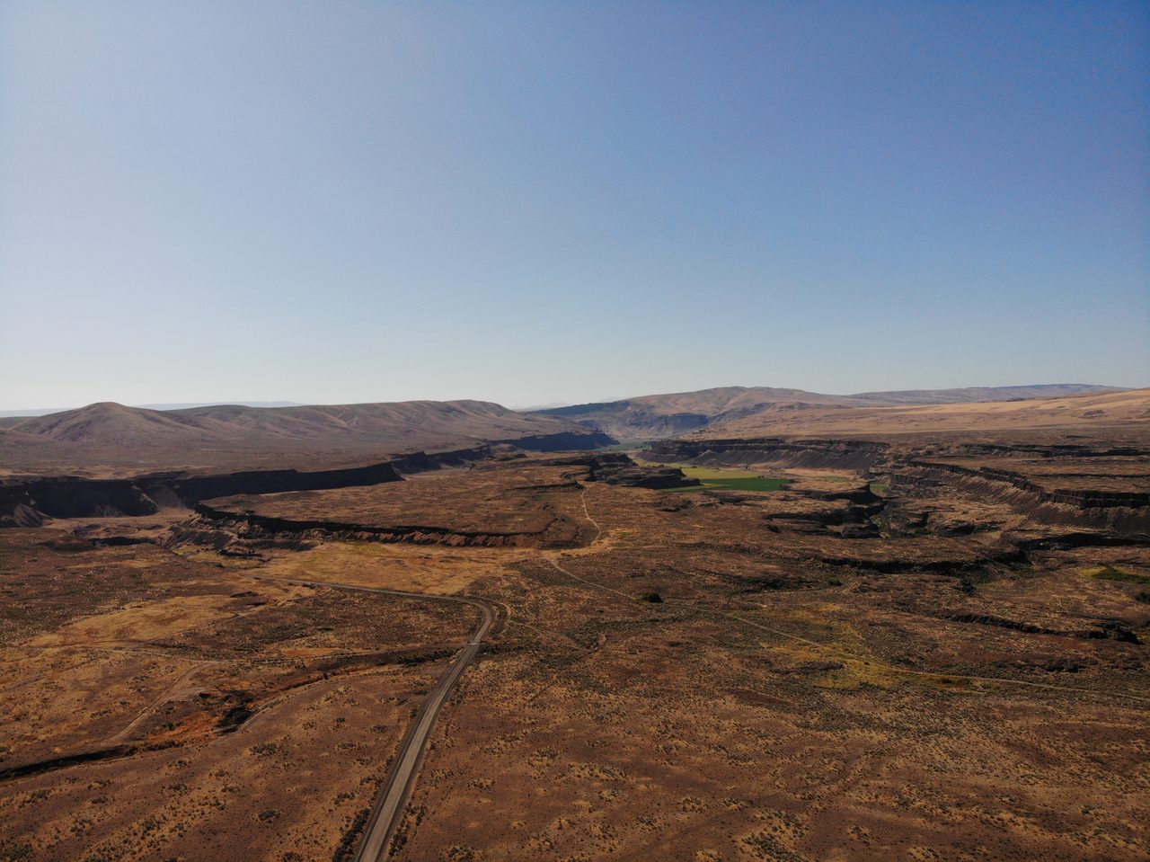
At the height of the last Ice Age, a tongue of the Cordilleran Ice Sheet dammed a river in northern Idaho and backed up a lake the size of an inland sea, roughly 2,500 cubic kilometers of water, about half the volume of modern Lake Michigan. Then the dam failed. The lake emptied in days, and the flood that tore across eastern Washington was the greatest freshwater discharge known on Earth. It happened dozens of times. This is the story of the Missoula Floods and the scarred land they left behind, opened claim by claim, each one wearing its evidence.
Start with the water, because nothing else about this landscape makes sense without it. At the peak of the last Ice Age a lobe of the Cordilleran Ice Sheet slid south into a river valley in what is now northern Idaho and froze into a dam of ice. Behind it rose a lake deep enough to drown a mountain range. When the ice gave way, the lake did not leak. It emptied, in days, in the largest freshwater floods geologists have ever been able to measure. And then the ice came back, and it happened again. Let's open the file.
01An Ice Dam and an Inland Sea
Glacial Lake Missoula was born from a plug of ice. As the last Ice Age tightened its grip, the Purcell Trench lobe of the Cordilleran Ice Sheet, also called the Clark Fork lobe, pushed south into the Clark Fork River valley of what is now northern Idaho and dammed it near the site of modern Lake Pend Oreille. The river had nowhere to go, so it began to fill the valleys behind the ice.
At its highest, the lake was enormous. It stood roughly 300 meters deep against the ice dam, reached about 300 kilometers eastward across the mountain valleys of western Montana, and held on the order of 2,500 cubic kilometers of water. That is a body of water the size of a large inland sea, held back by nothing but a wall of ice.
To put 2,500 cubic kilometers in perspective, set it beside the Great Lakes. Glacial Lake Missoula held roughly half the volume of modern Lake Michigan. All of that water was stored behind an ice dam that could not last, and did not.
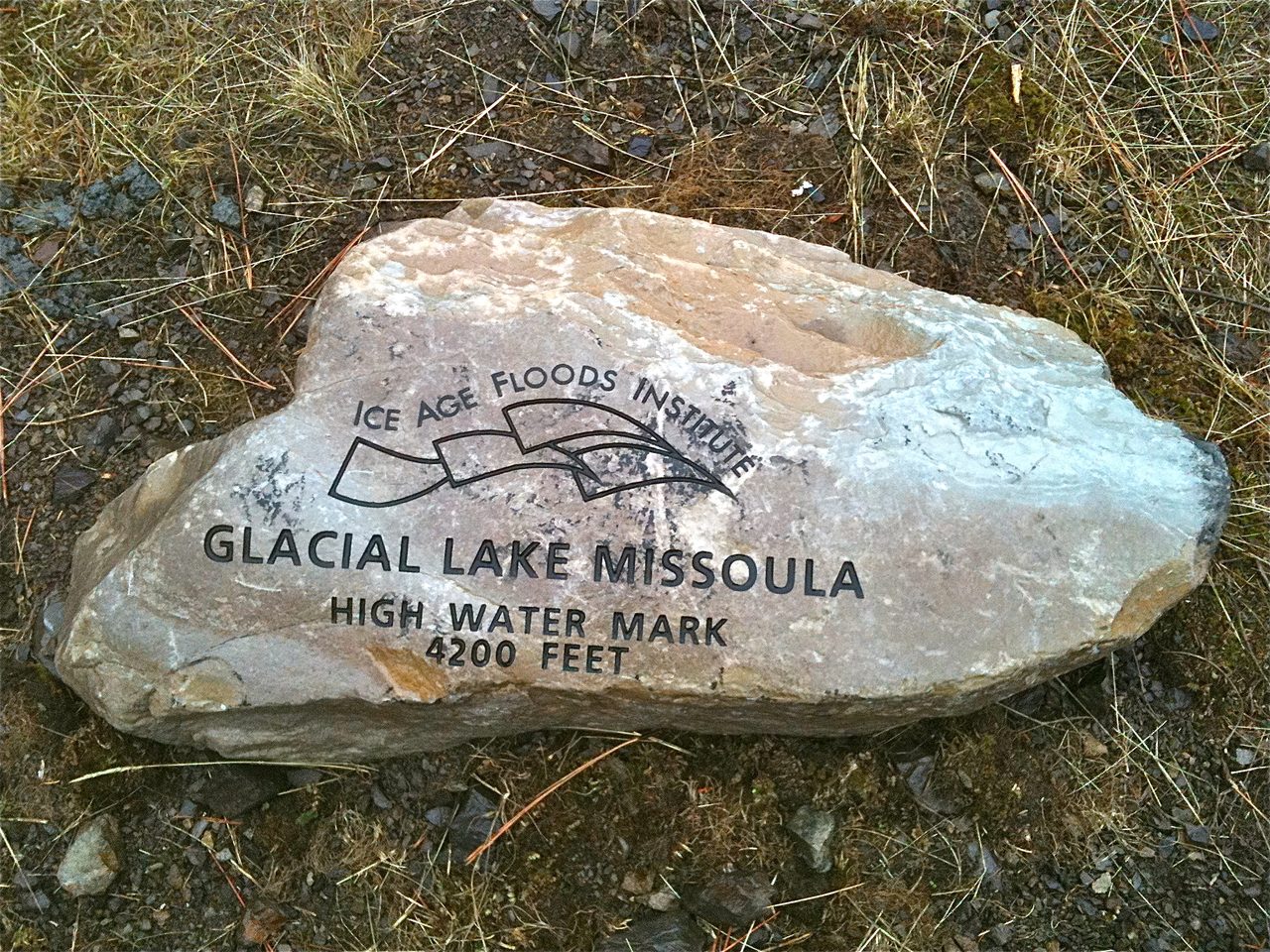
The proof that the lake existed is still written on the hillsides above Missoula, Montana. More than 30 horizontal shorelines, or strandlines, are cut into the flanks of Mount Sentinel and Mount Jumbo, each one a bench marking a level where the lake surface once stood. Stacked one above another, they record a lake that filled and drained again and again rather than a single time.
That is exactly what happened. The full cycle, ice dam, filling lake, dam failure, catastrophic drainage, then a fresh dam as the ice pushed south again, repeated dozens of times over a span of roughly 2,000 to 3,000 years, between about 18,000 and 15,000 years ago. Every turn of the cycle ended in a flood.
02The Scars It Left Behind
When those floods reached the Columbia Plateau of eastern Washington, they carved a landscape unlike anywhere else on Earth. The geologist J Harlen Bretz named it the Channeled Scablands: an expanse of roughly 15,000 to 40,000 square kilometers of deep dry canyons, abandoned waterfalls, and basalt scraped clean of its soil, threaded by dead channels and streamlined hills. It looks like the bed of a river that has been switched off.
The largest of the carved channels are the coulees. Grand Coulee runs about 80 kilometers long, between 1.5 and 10 kilometers wide, and as much as 300 meters deep in places, a canyon cut not by a river over millions of years but by floods over days. Moses Coulee is another of the great dry channels in the same system.
The single most dramatic feature is Dry Falls, a horseshoe-shaped cataract 120 meters high and 5.5 kilometers wide. It is the scar of a waterfall that has fallen completely silent, a curving cliff line with no river above it, standing over empty plunge pools.
The scale is hard to hold in the mind, so try a familiar yardstick. The entire combined crest of Niagara Falls, all three of its falls counted together, is a little over one kilometer across. Dry Falls is more than five kilometers across, and today not a drop goes over it.
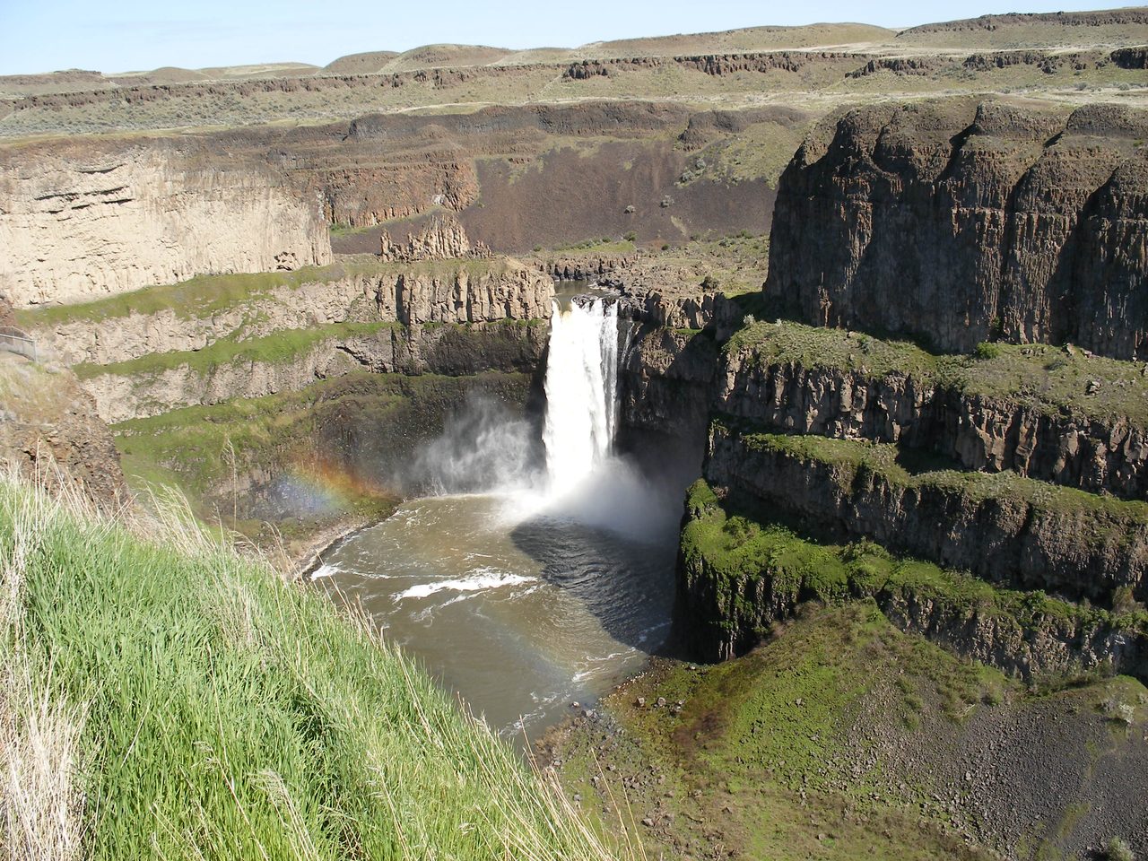
The floods left their signature in more than the big canyons. Across the plateau they stripped away the loess, the wind-blown soil, to expose bare Columbia River basalt, the raw scabland that gives the region its name. They left hanging valleys, side channels whose floors now sit tens of meters above the scoured main channel they once fed. And they left streamlined hills, teardrop-shaped remnants of loess sculpted by water that flowed around them, sometimes called loess islands.
| Evidence | What It Records |
|---|---|
| Giant current ripples | Gravel dunes up to about 15 m high, the largest current ripples known on Earth, at Camas Prairie, Montana |
| Ice Age erratics | Basalt boulders over 10 m across, carried tens to hundreds of km and stranded on high ground |
| Slackwater rhythmites | Stacks of fine flood layers, 40-plus counted at Burlingame Canyon, one couplet per flood pulse |
| Scoured basalt | Loess stripped to bare rock across the plateau |
| Streamlined loess hills | Remnant hills shaped by floodwater flowing around them |
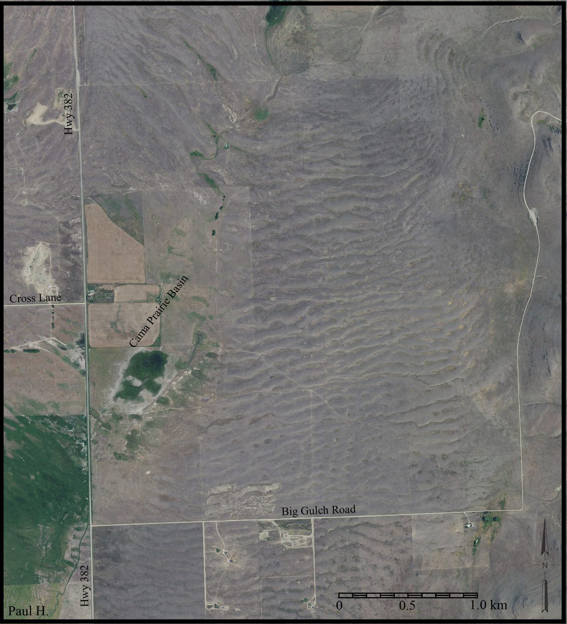
The strangest deposits are the giant current ripples. These are gravel dunes, up to about 15 meters high with wavelengths reaching 150 meters, the exact shape of the little ripples water leaves in sand on a streambed, only built at monstrous scale. The best examples lie at Camas Prairie, Montana, where they are recognized as the largest current ripples known anywhere on Earth. You can really only take them in from the air.
The floods also moved rock in bulk. Basalt boulders more than 10 meters across were carried tens to hundreds of kilometers by the floodwaters and stranded on high ground far from any source. A cluster of these erratics still rests on Red Mountain in the mid-Columbia region of Washington, an isolated hill that stood as an island in the flood, confirming the water rose there to roughly 1,200 feet above sea level.
And in the quiet backwaters, where floodwater ponded up the side valleys and slowed, it dropped its fine sediment in neat layers called rhythmites, one couplet for each flood pulse. At sites like Burlingame Canyon, Washington, geologists have counted more than 40 separate flood layers stacked in order, some of the strongest physical evidence that there were many floods, not one.
03The Greatest Flood We Can Measure
Numbers turn the Scablands from a curiosity into something almost unbelievable. The land records not just that a flood came through but how hard it hit, and the figures put it in a class of its own.
At their peak, the largest floods discharged an estimated 10 to 17 million cubic meters of water per second. That is the greatest freshwater discharge known anywhere on Earth, roughly 10 times the combined flow of every river on the planet today, all of it forced through a handful of channels in eastern Washington.
Where the flood squeezed through constrictions it accelerated. Flow velocities in those narrows are estimated at 20 to 30 meters per second, somewhere between 45 and 67 miles per hour, fast enough to keep the giant boulders it left behind in motion and to grind its channels straight into solid basalt.
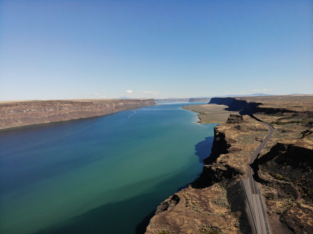
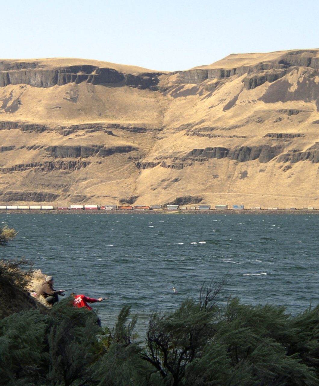
The water was not only fast but deep. In the major channelways it ran 100 to 250 meters deep. Where it met a bottleneck it backed up: at Wallula Gap, the narrow notch the Columbia River threads through, the flood ponded against the constriction and rose to about 370 meters above sea level, drowning the land upstream until it could force its way through.
| Measure | What the Evidence Gives |
|---|---|
| The lake | About 2,500 cubic km, roughly half the volume of modern Lake Michigan |
| Lake depth at the dam | Roughly 300 m |
| Peak discharge | About 10 to 17 million cubic meters per second |
| That discharge, in context | The greatest freshwater flow known on Earth, roughly 10 times every river on the planet combined |
| Flow speed in the narrows | 20 to 30 meters per second, about 45 to 67 mph |
| Flow depth | 100 to 250 m in the main channels; ponded to about 370 m elevation at Wallula Gap |
| The floods, repeated | Dozens of times over roughly 2,000 to 3,000 years |
04The Man Who Was Right Too Soon
None of this was accepted at first. A landscape carved in days rather than ages was exactly the kind of claim geology had spent a century learning to distrust, and the man who made it paid for it for most of his life.
In 1923, the geologist J Harlen Bretz published a paper in the Journal of Geology titled 'The Channeled Scablands of the Columbia Plateau,' arguing that the whole scarred region had been cut by a sudden, catastrophic flood.
In January 1927, Bretz laid out his evidence before the Geological Society of Washington. The established geologists in the room rejected it almost to a person, on the principle that catastrophic floods had no place in modern geology. Their criticism came with a telling gap: not one of them offered any alternative explanation for how the Scablands had actually formed.
The critics' strongest point was a fair one: where could a flood that big possibly have come from? The answer came from another geologist, Joseph Thomas Pardee, who had been studying an ancient lake in the mountains of western Montana. Pardee documented Glacial Lake Missoula and even found its own giant ripple marks on the old lake bed, and in doing so he handed Bretz the missing water source his critics had demanded: a vast lake, held by ice, ready to fail.
The turning point came in 1965, when the International Association for Quaternary Research brought a field conference into the Scablands themselves. Standing in the dry coulees and beneath the abandoned falls, with the evidence laid out in the ground around them, the visiting geologists were largely won over.
The final vindication came in 1979, when the Geological Society of America gave Bretz its highest honor, the Penrose Medal. He was in his mid-nineties by then, most likely 97, though the sources differ and some give his age as 96. More than half a century after he was rejected, the discipline that had refused his flood accepted it.
| Year | What Happened |
|---|---|
| 1923 | Bretz publishes the catastrophic-flood origin of the Scablands in the Journal of Geology |
| 1927 | The Geological Society of Washington rejects it, and no one offers a rival explanation |
| 1940s onward | Pardee documents Glacial Lake Missoula, the missing water source |
| 1965 | An INQUA field conference walks the evidence in the field and is largely convinced |
| 1979 | Bretz receives the Penrose Medal, geology's highest honor |
05A Blueprint for Reading Mars
The vindication did not stop at the edge of the Scablands. It reached across the Solar System.
When spacecraft returned images of Mars showing enormous dry channels, features like Ares Vallis and Kasei Valles, geologists needed an earthly landscape to compare them against. The Channeled Scablands were the closest thing on Earth. Beginning in the 1970s, Vic Baker and others used the Scablands to argue that the Martian channels had themselves been carved by catastrophic megafloods early in the planet's history. Bretz's once-heretical flood became a working tool for reading the surface of another world, and part of how catastrophic processes won back a legitimate place in the earth sciences.
06The Questions Still Open
For all that is now settled about the floods, several real questions are not. These are the places where honest science says the file is still open.
The first is the simplest to ask and the hardest to answer: exactly how many floods were there? Estimates range from about 25 to more than 80. Careful counts of the stacked flood layers point to at least 40, but the true number is genuinely uncertain, because the smallest floods may have left no lasting deposit, and later floods scoured away the traces of earlier ones. The best current reading is a flood every 35 to 55 years on average, though the real intervals surely varied.
The second question is who, if anyone, was there to see them. There is limited but real evidence that Clovis or pre-Clovis people were present in the Pacific Northwest during the last of the flood cycles. The floods reshaped the human landscape either way, scouring the uplands while laying down the fertile bottomlands of the Willamette Valley and the Portland basin. No direct archaeological trace of anyone caught in a flood has ever been found, but repeated inundation of the Columbia corridor would have been a deadly hazard for anyone living in its path. On that point, the evidence is simply silent.
The third is whether the floods left a fingerprint on the world's climate. The floodwaters drained to the Pacific, not the Atlantic, which makes a direct effect on North Atlantic circulation unlikely, and for a long time that was where the question rested. But a 2020 study by Praetorius and colleagues in Science Advances reopened it, modeling how meltwater from the Columbia megafloods could have spread into the North Pacific and, under the right conditions, been routed north and around into the Atlantic within about a decade, reaching the very regions that drive global ocean circulation. It is a far more roundabout path than anyone had assumed, a peer-reviewed model rather than a settled result, and very much an open research question today.
07Where the Story Runs Off the Map
A story this dramatic attracts claims that run past the evidence. Some are worth entertaining as open questions. Others the rock rules out. Both deserve to be named plainly, because the honest account is more interesting than the mythology.
It is tempting to wonder whether the memory of the floods survived in the oral traditions of the region's first peoples. Some scholars, notably Clark in 1953, have pointed to flood stories told by the Kalispel, the Spokane, and other Plateau peoples and suggested a connection. It is an evocative idea, but the last floods were roughly 15,000 years ago, more than 600 generations back, and no oral tradition can be traced that far with any confidence. This one has to stay speculation.
One nuance is worth being honest about, because it is easy to flatten. Bretz's original 1923 idea was a single, one-time catastrophic flood. The modern consensus, built from the rhythmites, the strandlines, and the dating, is that there were dozens of separate floods, each catastrophic in its own right. So the version of the story that finally won is not quite the version Bretz first told. The catastrophic-flood origin he fought for is thoroughly vindicated; the single-flood detail is not, and has been superseded.
And no, the Missoula Floods are not evidence for Noah's Flood, despite being cited that way. They were genuinely catastrophic, but they were many separate events, not one; they were confined to the Pacific Northwest, not global; and they played out over thousands of years at the end of the Ice Age, not in a single worldwide deluge. The very things that make them scientifically real, the multiple floods, the local geography, the long timespan, are exactly what rule them out as one global flood.
Fast Facts
- The Event
- The Missoula Floods, a series of Ice Age megafloods across the Pacific Northwest
- When
- Roughly 18,000 to 15,000 years ago, over about 2,000 to 3,000 years
- The Lake
- Glacial Lake Missoula, about 2,500 cubic km, roughly half the volume of Lake Michigan
- The Dam
- A lobe of the Cordilleran Ice Sheet blocking the Clark Fork River in northern Idaho
- The Scablands
- About 15,000 to 40,000 sq km of scoured basalt, dry coulees, and abandoned falls in eastern Washington
- Signature Features
- Dry Falls (120 m high, 5.5 km wide), Grand Coulee, and the giant current ripples of Camas Prairie
- Peak Discharge
- About 10 to 17 million cubic meters per second, the greatest freshwater discharge known on Earth
- Number of Floods
- Debated, from about 25 to more than 80
- The Discoverer
- J Harlen Bretz, who proposed the floods in 1923, was rejected in 1927, and received the Penrose Medal in 1979
What We Can Actually Stand Behind
The floods are real, and their scale is not exaggerated. An ice dam in northern Idaho held back a lake of about 2,500 cubic kilometers, and when it failed the water tore across eastern Washington in the greatest freshwater floods known on Earth, carving the Channeled Scablands. It happened dozens of times over roughly 2,000 to 3,000 years, recorded by the strandlines, the coulees, the giant ripples, and the stacked flood layers. Bretz, ridiculed in 1927, was proven right. The one correction to his original idea is that there were many floods, not the single one he first proposed.
The Scablands are a genuine, accepted analogue for the giant flood channels of Mars, and they helped restore catastrophic processes to respectable geology. Two other questions stay credible but unresolved: exactly how many floods there were, somewhere between about 25 and more than 80, and whether people were already living in the flood's path when it came.
Whether Native oral traditions preserve a memory of the floods across 15,000 years, and whether the floodwaters left a real mark on North Atlantic circulation, are intriguing and genuinely open, but neither is established. The 2020 modeling that reopened the ocean question is a hypothesis to test, not a conclusion.
No, the Missoula Floods are not proof of a single worldwide flood such as Noah's. They were many separate events, confined to the Pacific Northwest, spread across thousands of years. The very features that make them real rule them out as one global deluge.
So the honest version outdoes the legend. There was no single world-drowning flood, but there was something almost stranger: a lake the size of an inland sea that formed, burst, and formed again, dozens of times, scouring a corner of a continent into a shape we can still read 15,000 years later. And the file is not closed. We still cannot say for certain how many times the dam broke, whether anyone stood on those shores to watch it go, or how far across the world's oceans the last of that cold water carried. The land has stopped changing. The questions have not, so how many times did the ice really give way, and how far did that flood's echo travel before the world forgot it?
Sources & further reading
Everything above is drawn from our research library on Theories of Anything. Open the full file to check the sourcing and go deeper.
Image credits
- An aerial view over the scoured basalt plateau of the Channeled Scablands near Dry Falls, central Washington DKRKaynor, photographed August 26, 2019 via Wikimedia Commons. CC BY-SA 4.0 Source.
- Grand Coulee and Steamboat Rock, a basalt butte standing on the floor of the flood-carved canyon in eastern Washington DKRKaynor, photographed August 26, 2019 via Wikimedia Commons. CC BY-SA 4.0 Source.
- Palouse Falls, a still-active waterfall in the Channeled Scablands of southeastern Washington, viewed from the Palouse Falls State Park overlook PJ Blalock, photographed April 1, 2007 via Wikimedia Commons. Public Domain Source.
- An aerial view of the giant current ripples (megaripples) near Camas Hot Springs, Montana, the enormous gravel dune deposits formed by the Missoula floods, the largest current ripples known on Earth Paul H., uploaded July 9, 2024 via Wikimedia Commons. CC BY 4.0 Source.
- Wallula Gap, Washington, the narrow constriction on the Columbia River where floodwaters ponded and rose during the Missoula Floods Williamborg, photographed September 2006 via Wikimedia Commons. Dual-licensed GNU Free Documentation License 1.2+ and CC BY-SA 3.0 Unported Source.
- A rock on a ridge overlooking the Rattlesnake area near Missoula, Montana, marked by the Ice Age Floods Institute as showing the high water mark for Glacial Lake Missoula at 4,200 feet elevation Djembayz, photographed October 14, 2011 via Wikimedia Commons. CC0 1.0 Universal Public Domain Dedication Source.
- An aerial view over the scoured basalt plateau of the Channeled Scablands near Dry Falls, central Washington (card crop) DKRKaynor, photographed August 26, 2019 via Wikimedia Commons. CC BY-SA 4.0 Source.


