
The Maya Collapse: The Cities That Went Silent, and the People Who Did Not Vanish
Between roughly 800 and 1000 CE, dozens of cities in the southern Maya lowlands stopped carving dates. Quirigua's last monument went up in 810 CE, Copan's in 822, Tikal's in 869, and on a monument at Tonina in 909 CE somebody cut the last Long Count date anyone in the lowlands would ever cut. The rainfall record for those centuries is among the sharpest we have for any ancient collapse, and one study puts the fall in annual precipitation at 41 to 54 percent. But the same droughts fell on the northern Yucatan, where Chichen Itza was rising rather than emptying, and a 2025 modelling study finds cities being abandoned as conditions improved. This is the file, opened claim by claim, each one wearing its evidence. It scopes to the southern lowlands, because that is where the collapse happened, and it starts from the finding our own research file puts in Tier 4: the Maya did not disappear.
Start with what is not in dispute. Somewhere around 810 CE the carvers at Quirigua cut a date into stone for the last time. That is the earliest of the last dated monuments, though the city-by-city sequence in section 02 opens about a decade earlier still, at Palenque, whose entry is a recorded ruler rather than a carved monument. Over the following century the same silence spread city by city across the southern Maya lowlands, and then it was over: no one in the lowlands carved a Long Count date again. What ended in those two centuries was a political and cultural order, meaning dated monuments, dynastic kings, palace construction and cities holding tens of thousands of people. What did not end was the Maya. While the southern cities were going quiet, Chichen Itza in the northern Yucatan was becoming a major power, and more than six million Maya people are alive in Mexico, Guatemala, Belize, Honduras and El Salvador today. Both of those facts belong in the opening paragraph, because the story this article has to work against keeps one of them in a footnote. Let's open the file.
01What The Classic Maya Had Built
Before anything about how it ended, the thing itself. The southern lowlands here means modern Guatemala, Belize, western Honduras and southern Mexico, and what stood there in the eighth century was not a single kingdom but a crowded political landscape of rival capitals.
At its height, roughly 600 to 800 CE, the Classic Maya civilization spanned hundreds of polities and raised monumental architecture of extraordinary sophistication at Tikal, Calakmul, Copan, Palenque, Caracol and Naranjo. It developed the most complete writing system in the pre-Columbian Americas, the Maya hieroglyphs; an elaborate Long Count calendar; and sophisticated knowledge of astronomy, mathematics including the concept of zero, and agriculture.
The collapse was not an event. It was a gradual, diachronous process running roughly 150 to 200 years, from about 800 to about 1000 CE, and our own research file's key finding calls it a rolling wave of abandonment. Any telling that puts it in a year, or in a single failed harvest, is telling something the file itself refuses in its opening summary.
What archaeologists actually count, when they say a Maya city collapsed, is four things: the cessation of dated stelae, meaning the last Long Count dates carved in stone; the end of elite construction; the abandonment of palace and ceremonial compounds; and dramatic population decline. Notice that three of the four are measures of what the ruling order stopped doing. That distinction runs through this whole article.
02The Last Dates, City By City
The Maya recorded their own history in stone with a precision no other pre-Columbian society matched, which means the collapse left a paper trail of exactly the kind historians almost never get. Each city has a final date. Laid out in order, they are the clearest single picture of what a rolling wave looks like.
The wave opens in the west. Palenque's last recorded ruler is placed at about 799 CE, and the city was abandoned by roughly 850 CE. One caution on that first number, since this article would rather be exact than tidy: our own file says the last recorded ruler died in 799, while the wider literature more usually records 799 as an accession date for Palenque's last known ruler. This pass did not resolve which, so the year is carried here as attached to that ruler generally, not to a specific event.
Then the sequence tightens. Quirigua's last dated monument is 810 CE. Naranjo's last stela is 820 CE. Within a single decade, two established capitals stop recording themselves.
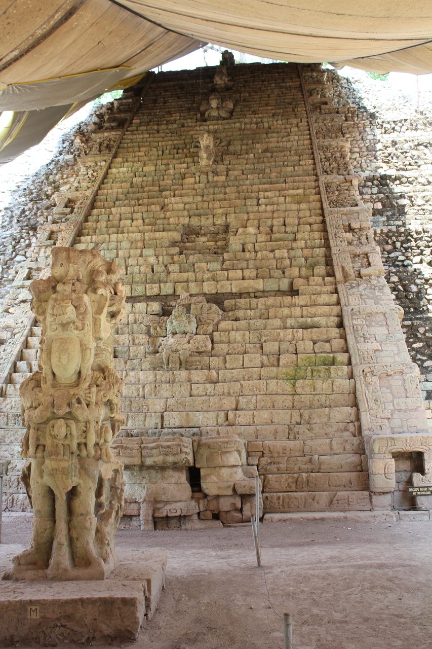
Copan's last carved monument is dated 822 CE, and it is the most eloquent object in this entire file, because the carvers did not finish it. It is Altar L, an altar rather than a stela. One face carries the enthronement scene of the ruler Ukit Took', a second face was begun, and two faces were left entirely blank. Ukit Took' acceded on 6 February 822 and, on the surviving evidence, was never fully installed as king. A correction to our own file belongs here in the open: E_5_04 calls this monument a stela in two places. It is an altar, and this article uses the externally verified description.
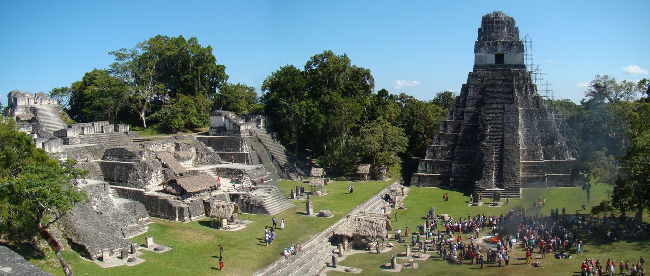
Tikal held on longer, and its last monument is a similar kind of witness. Stela 11 is the only monument from the Terminal Classic period found at Tikal. It carries the Long Count date 10.2.0.0.0, 3 Ajaw 3 Kej, corresponding to 869 CE, the latest date yet recovered and deciphered at the site. It was erected in the Great Plaza by Jasaw Chan K'awiil II, Tikal's last known ruler identifiable from surviving inscriptions, and it is best read as an attempt to revive royal power at a much-diminished city. This is not a monument to a thriving capital. It is a monument raised in a city already mostly gone.
Calakmul's last dated stela is 909 CE, and the same year closes the record entirely. Tonina Monument 101 carries the Long Count position 10.4.0.0.0, 12 Ahau 3 Wo, corresponding to January 909 CE: the last known Long Count date in the Maya area. The monument depicts a ruler and marks a katun ending, and the name of that king does not survive. Sources differ by a few days on the Gregorian equivalent, a correlation-constant difference rather than a disagreement about the monument, so this article says January 909 and leaves the day open.
| City | The Monument | Date |
|---|---|---|
| Palenque | Last recorded ruler; the city abandoned by roughly 850 CE | c. 799 CE |
| Quirigua | Last dated monument | 810 CE |
| Naranjo | Last stela | 820 CE |
| Copan | Altar L, an altar, left unfinished: one face carved with the enthronement of Ukit Took', one begun, two blank | 822 CE |
| Tikal | Stela 11, Long Count 10.2.0.0.0, raised in the Great Plaza by Jasaw Chan K'awiil II | 869 CE |
| Calakmul | Last dated stela | 909 CE |
| Tonina | Monument 101, Long Count 10.4.0.0.0, the last known Long Count date in the Maya area | 909 CE |
03How Many People, And How Many Left
Monuments are the sharp edge of the record. Population is the blunt one, and it is where the numbers in circulation are widest. Our own file does not agree with itself here, so this article says so rather than picking the figure that reads best.
Estimates of peak Classic Maya population in the southern lowlands range from 3 to 10 million, with some estimates as high as 15 million depending on the geographic scope. Our own file states this range in its body and separately states 10 to 15 million in its summary, without declaring the wider scope that would justify the higher figure. Those two statements do not sit together, and this article carries the body range as the sourced one.
There is a published number that grounds the high end, and our file does not cite it. In 2018 Canuto, Estrada-Belli and colleagues published in Science the results of a consortium of 18 scholars, enabled by Fundacion PACUNAM, analysing airborne laser scanning data across more than 2,100 square kilometers of the Maya Biosphere Reserve in northern Guatemala. It was the largest single lidar survey in the history of Mesoamerican archaeology. The team identified 61,480 ancient structures, derived an average population density of about 120 people per square kilometer, and estimated 7 to 11 million people at the height of the Late Classic period, 650 to 800 CE.
Whatever the peak was, the fall from it was severe. Populations in the southern lowlands declined by an estimated 90 to 95 percent between 800 and 1000 CE, on the evidence of lost settlement density in archaeological surveys, reduced ceramic production, and the absence of monumental construction. Read that number for exactly what it is: a regional depopulation figure for the southern lowlands. It is not a figure about Maya people, and the next section is where it gets its context rather than its footnote.
Some areas of the southern lowlands were essentially depopulated and never significantly reoccupied before the Spanish arrival. That is the part of the story the jungle-swallowed-city photographs actually earn, and it applies to particular districts of one region, not to the Maya world.
04Not A Total Civilizational Extinction
That heading is not this article's invention. It is the heading our own research file gives to a dedicated Tier 1 subsection, and the file deserves credit for putting the correction where the finding is instead of at the end. Everything in this section is verified, and none of it is a caveat.
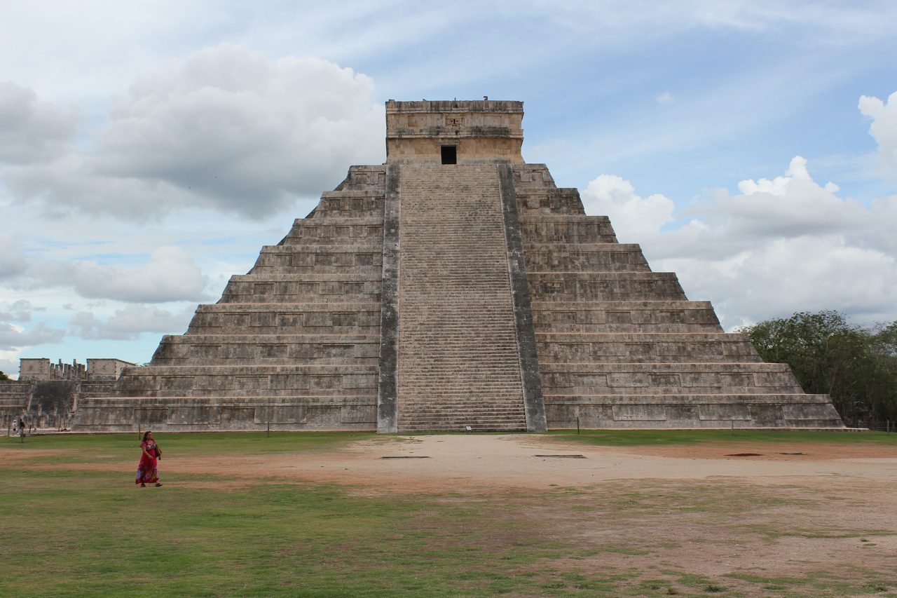
The Maya civilization did not completely disappear. While the southern cities were being abandoned, the northern Yucatan flourished: the Puuc region, meaning Uxmal, Kabah and Labna, and above all Chichen Itza. The same centuries that read as an ending in the Peten read as an ascent in the north.
Chichen Itza was a major power from roughly 900 to 1100 CE, and Mayapan followed it from roughly 1200 to 1450 CE. Set those dates against the table above. Chichen Itza's rise begins in the same generation as Tonina's last inscription.
The north's exemption was real but partial and temporary, and a 2016 study says so precisely. Hoggarth, Kennett and colleagues, publishing in Global and Planetary Change, combined Bayesian radiocarbon models, calendar dates on carved monuments and climate proxies, and identified three major intervals of drought between 820 and 1100 CE and two separate waves of political collapse: the asynchronous collapse of multiple southern polities between about 850 and 925 CE, and then the political collapse of Chichen Itza itself between about 1000 and 1050 CE, coinciding with the longest and most severe drought in the regional record, 1000 to 1100 CE. Political developments through the Postclassic, 1000 to 1517 CE, correspond with a return to higher rainfall. The northern Maya did not escape drought. They met a different drought on a different timetable.
At the time of Spanish contact, a period running from 1524 to 1697 CE, millions of Maya-speaking people inhabited Yucatan, Guatemala and adjacent regions. That end date is worth its own sentence. The Itza Maya at Nojpeten, on Lake Peten Itza, did not fall to the Spanish until 1697: more than eight centuries after Tikal raised its last stela, an independent Maya kingdom was still holding out, in the same lowlands.

So, flatly: no, the Maya did not disappear. Our own file files that claim in Tier 4 as debunked, and puts a living-population figure beside it. Approximately 6 to 7 million Maya-speaking people live in Mexico, Guatemala, Belize, Honduras and El Salvador today, and that is the floor rather than the ceiling: the Smithsonian's National Museum of the American Indian states that more than seven million Maya live in their original homelands in Mesoamerica and in countries around the world. Britannica gives roughly 30 Mayan languages spoken by more than five million people in the early 21st century, most of those speakers bilingual in Spanish, and in Guatemala alone figures in the 6.5 million range are reported across the country's 22 Maya peoples. The totals differ because they count different things, people or language speakers, so take the range and note which is which. The Classic Maya collapse was a regional phenomenon confined to the southern lowlands. It was the end of a particular political and cultural system, not the extinction of a people.
05The Rain, Measured Four Ways
Now the evidence that made this collapse famous. Four independent paleoclimate records cover these centuries, they were built by different methods on different materials in different places, and they agree that the rain failed. This is the only causal family in the file that carries hard numbers at Tier 1, and it still is not the answer on its own.
The first record came out of the sea. Gerald Haug and colleagues, publishing in Science in 2003, measured titanium concentrations in a marine sediment core from the Cariaco Basin off Venezuela, where titanium serves as a proxy for terrestrial runoff and therefore for rainfall on land. The record shows three intense multi-year droughts centred at approximately 810, 860 and 910 CE, each lasting several years, with the wet periods between them briefer than the climatological mean. Compare those three dates with the last-monument table and the correlation looks uncanny.
Which is exactly why the brake belongs immediately after, and our own file supplies it in its counter-arguments. The exact correlation between specific drought events in paleoclimate records and specific polity collapse dates from epigraphy has been questioned. Sediment core dating often carries uncertainties of decades, which makes precise cause-and-effect attribution difficult. A correlation that looks tight to the year may be a correlation between a carved date good to the day and a sediment date good to a human lifetime.
The second record came out of a cave, and it says more than it is usually quoted as saying. Douglas Kennett and colleagues, publishing in Science in 2012, ran oxygen isotope analysis on a precisely dated speleothem from Yok Balum Cave in Belize. The record describes a sequence, not a single peak: anomalously high rainfall between 440 and 660 CE, which favoured unprecedented population expansion and the proliferation of political centres; a drying trend from 660 to 1000 CE, which the authors tie to the balkanization of polities, increased warfare and the asynchronous disintegration of polities, with multidecadal droughts particularly between 820 and 870 CE and roughly a 40 percent reduction in summer rainfall across the Terminal Classic; and then population collapse in the context of an extended drought from 1020 to 1100 CE. That last window sits later than the 800 to 1000 CE range section 03 gives for the regional population fall, and the two are not measuring the same thing: section 03's figure is a survey-based estimate of how much of the southern lowland population was lost across those two centuries, while this one is a single cave record placing population collapse against its own rainfall sequence. Both are carried here as their sources state them. Note what that first interval means: on this record, climate helped build the Classic Maya world before it helped unmake it. One correction to our own file, because it compresses this paper: the superlative driest period in the past 2,000 years belongs to the 1020 to 1100 drought, after the Terminal Classic, and should not be attached to the collapse window.
The third record put a number on it, and it is the best-sourced figure in this article. Nicholas Evans and colleagues, publishing in Science in 2018, applied gypsum isotope hydrology to sediment cores from Lake Chichancanab in Yucatan, analysing the water structurally bound inside sedimentary gypsum that was laid down under drought conditions. They estimated that annual precipitation fell by 41 to 54 percent during the most severe Terminal Classic droughts, with intervals of up to 70 percent reduction during the driest episodes. The same study found relative humidity down by 2 to 7 percent against present-day levels. This is what a halved rainfall looks like when somebody finally measures it instead of inferring it.
The fourth record is new, and it is the one that makes the drought human-scaled. James and colleagues, publishing in Science Advances in August 2025, ran oxygen-isotope analysis on a stalagmite from a cave in northwest Yucatan and resolved rainfall for individual wet and dry seasons between 871 and 1021 CE, the first time seasonal resolution has been achieved for the Terminal Classic. The record contains droughts lasting from 1 to 13 years, including one that ran the full 13. And its own headline finding points away from a single story: political activity at major northern sites including Chichen Itza and Uxmal declined at different times relative to those droughts, implying differential cultural responses to the same climate stress.
06Why Drought Alone Does Not Explain It
Here is the sentence that has to come before any causal story, and it is Tier 1, and it is in our own file's opening summary rather than buried in a caveat at the back.
Drought alone does not explain the collapse. The contemporary northern Yucatecan Maya, at Uxmal and Chichen Itza, experienced the same droughts and survived them, or flourished through them, during the Terminal Classic. If the same rain fell on the north and the north did not empty, then rainfall by itself is not the explanation for the south.
Our file goes further and names the failure mode by its scholarly name. Researchers caution against environmental determinism, meaning over-attributing the collapse to drought while underweighting human agency, political dynamics and social factors. That northern survival suggests institutional resilience, geographic factors such as access to cenotes and coastal resources, and different political structures mattered as much as climate did. Cenotes are the point worth holding on to, because it turns an abstraction into a landscape: in the north, permanent water sat in open sinkholes below the surface even in years when the rain did not come.
07What Else Was Failing
So if not drought alone, then what? Four further families of cause sit in the record, and the discipline that matters here is keeping them apart. They are not one cascade with drought at the top. They are separate bodies of evidence, at their own tiers, argued by different people, and the honest presentation is a list rather than a chain.
Our file's stated emerging consensus, synthesized from David Webster's The Fall of the Ancient Maya (2002), Richardson Gill's The Great Maya Droughts (2000) and the work of Takeshi Inomata and colleagues, is multi-causal: prolonged drought acted as the ultimate stressor on a system already weakened by overpopulation relative to agricultural capacity, by deforestation and soil erosion in the thin karstic soils of the Peten, by intensified warfare between rival polities, and by the erosion of political legitimacy as divine kings proved unable to deliver rainfall and prosperity. The collapse was a combined ecological, political and social failure. Read the operative phrase carefully. It says drought was the ultimate stressor on an already weakened system, which is a different sentence from drought caused the collapse.
Family one, the forest. Pollen core studies from multiple lowland lakes, including Lake Salpeten, Lago Petexbatun and Lake Peten Itza, show evidence of massive deforestation during the Late Classic, with forest pollen declining dramatically and disturbance indicators such as grasses and weeds increasing.
David Lentz and colleagues documented that clearance around Tikal in 2014, estimating that the Tikal polity cleared roughly 80 percent of its surrounding forest for agriculture, construction timber and lime plaster production, burning enormous quantities of wood to make the white plaster that covered Maya buildings. That last detail is the one to sit with: the brilliant white cities were, quite literally, built by burning the forest they stood in.
Why that would matter is a mechanism argument rather than a measurement, and our file states it in the conditional, which this article keeps. Deforestation on the thin karstic soils of the Peten would have exacerbated drought impacts by reducing soil moisture retention, increasing surface runoff and erosion, and potentially altering local rainfall patterns. Would have. Potentially. Those words are load-bearing.
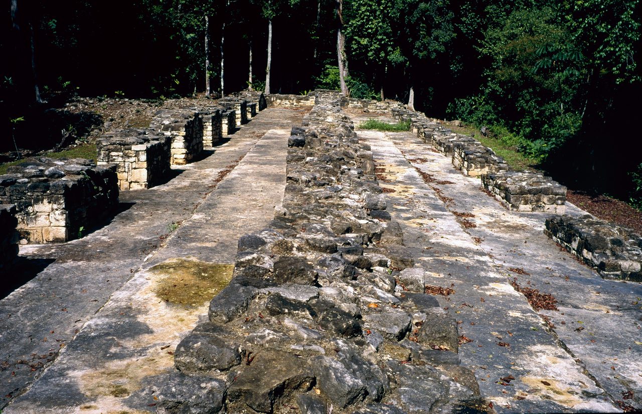
Family two, war. Hieroglyphic texts and archaeological evidence document escalating warfare among lowland Maya polities during the 8th and 9th centuries CE, and defensive walls, hastily built fortifications and evidence of violent destruction increase dramatically in the 9th century at multiple sites. The word hastily is doing real work there: these are not the works of a state planning ahead.
The best-excavated instance is the Petexbatun War of the late 8th century, documented by Arthur Demarest of Vanderbilt University through excavations at Dos Pilas, Aguateca and surrounding sites. It shows a wave of destruction, fortification building, and eventual abandonment directly caused by interstate warfare.
Whether warfare was a cause or a symptom is genuinely unresolved, and this article does not resolve it. On one reading, drought-induced food scarcity likely intensified conflict over diminishing resources, which makes war a downstream effect. On the other, Demarest emphasizes that in the Petexbatun region warfare clearly preceded the major drought episodes, which would make political fragmentation and militarism independent causes rather than drought consequences. That second position comes from the scholar who dug the relevant sites, and it is the strongest single argument against a drought-first narrative. Both readings are carried here at strength.
Family three, the throne. Classic Maya political legitimacy rested on the k'uhul ajaw, the divine king, as intermediary between the human and supernatural worlds, responsible for propitiation rituals including bloodletting ceremonies and invocations to bring rain. That job description is the vulnerability: a ruler whose authority is founded on delivering rain has staked it on the weather.
Lisa Lucero argued in 2002 that when drought persisted despite royal rituals, the ideological foundation of divine kingship eroded and populations lost faith in the ruling elite's ability to manage the cosmic order. Keep the attribution visible, because this is the most narratively attractive claim in the whole file and among the least directly evidenced. It is one named scholar's argument, at Tier 2, and it is offered here as that.
There is a physical trace that fits it, and it cuts against the emptying story hard. At several sites, late occupation phases show non-elite squatters occupying former palace and ceremonial spaces, which suggests the breakdown of social hierarchy preceded final abandonment. People were still there. They were living in the throne rooms. The cities did not empty first: the ruling order failed first.
Family four, the arithmetic of land. Richardson Gill, in The Great Maya Droughts (2000), emphasized that Late Classic Maya populations had likely exceeded the sustainable carrying capacity of their landscape, a conclusion supported by soil exhaustion, widespread terracing that indicates pressure on marginal land, and agriculture expanding into the bajos, the seasonal swamplands. Under normal rainfall the overshoot was manageable; under drought the food production shortfall became catastrophic. That is the cleanest one-sentence version of the multi-causal thesis anywhere in our file, and it is worth noticing that it sits at Tier 2, not Tier 1.
| Family | Tier | What The Evidence Is | Where It Is Weak |
|---|---|---|---|
| Drought | Tier 1 | Four independent paleoclimate records: Cariaco Basin titanium, the Yok Balum speleothem, Lake Chichancanab gypsum, and a seasonally resolved northwest Yucatan stalagmite | Sediment dating carries decade-scale uncertainty, so matching a drought to a city's last date is looser than the correlation looks. And the same droughts fell on the north, which did not empty |
| Deforestation And Soil Loss | Tier 2 | Pollen cores from multiple lowland lakes showing forest decline and disturbance indicators; a site study at Tikal quantifying the clearance | The step from clearance to collapse is a mechanism argument stated in the conditional, not a measurement |
| Warfare | Tier 2 | Hieroglyphic texts, defensive walls, hasty fortification, destruction layers, and the excavated Petexbatun sites | Cause or symptom is unresolved. In the Petexbatun, warfare preceded the major droughts |
| Collapse Of Divine Kingship | Tier 2 | The k'uhul ajaw's rain-bringing role in the inscriptions; non-elite squatters in former palace and ceremonial spaces | Rests on one named scholar's 2002 argument. The most narratively attractive claim in the file and among the least directly evidenced |
| Population Overshoot | Tier 2 | Soil exhaustion, widespread terracing on marginal land, agriculture pushed into the bajos | Carrying capacity is inferred from land use rather than measured |
| Volcanic Trigger | Tier 3 | A sulfate spike in ice cores from an unidentified tropical eruption, coinciding with the first pulse of collapse | Direct evidence linking that eruption to Maya drought is lacking |
| Epidemic Disease | Tier 3 | Proposed by analogy with other population declines | No pathogen has been identified in the pre-Columbian Maya record for the Terminal Classic |
| Refugee Cascade | Tier 3 | Proposed on the pattern of sequential, spreading collapse | Rated plausible but difficult to demonstrate archaeologically |
08Three Ideas That Have Not Earned More
Below the four families sit three further proposals. Our file rates them speculative, and so does this article. They are here because leaving them out would misrepresent what is being argued, not because the evidence carries them.
An eruption of an unidentified tropical volcano in 818 to 822 CE, detected as a sulfate spike in ice cores, may have contributed short-term cooling or climate disruption coinciding with the first pulse of collapse. Direct evidence linking this eruption to Maya drought is lacking, and note that the volcano itself has no name because nobody has identified it.
Researchers have speculated that epidemic diseases, unrelated to the post-contact Old World diseases that came later, may have contributed to the population decline. No specific pathogen has been identified in the pre-Columbian Maya record for the Terminal Classic, which leaves this as a shape in the data with nothing in it.
Takeshi Inomata and colleagues have suggested the collapse may have involved cascading refugee movements, with populations fleeing drought-stricken or warfare-torn polities overwhelming neighbouring polities' capacity and triggering sequential collapses. Our file rates this plausible but difficult to demonstrate archaeologically, and the difficulty is real: the pattern such a cascade would leave looks a great deal like the pattern several other explanations would leave.
09The Arrow Is Still Being Argued
It would be comfortable to close by declaring drought the ultimate stressor and calling it settled. The 2025 literature will not allow it, and the reason is not a fringe objection.
In 2025, McCool, Codding, Kennett and colleagues published in the Proceedings of the National Academy of Sciences a study applying population-ecology models and piecewise structural equation models to paleoclimatological and demographic data for the Classic Period Maya lowlands, 250 to 1000 CE. They find that the rise and expansion of Classic Maya cities resulted from the interaction of climate downturns, intergroup conflict and strong economies of scale realized through capital investment in agricultural infrastructure. Their reported counterintuitive result is that the abandonment of cities occurred under improving climatic conditions, at the point when conditions in rural areas got better.
Hold that carefully, because it is easy to misuse in both directions. It is one recent modelling study, not a consensus overturn, and it does not deny that the severe droughts happened: the four records in section 05 stand exactly as they stood. What it does is put the causal arrow itself in play at the top of the field, in 2025, in a paper co-authored by Douglas Kennett, who is also an author of the Yok Balum drought study our own file leans on. That is not a contradiction anyone caught anyone else in. It is a field still arguing, in public, with its own best evidence. This article names no winner, because the discipline has not.
10What The Collapse Was Not
Two claims about this collapse travel further than any of the evidence above, and both belong in Tier 4. One has already been answered in section 04. The other is about a calendar.
No, the collapse has no supernatural explanation, and it has nothing to do with the supposed end of the Maya calendar in 2012 CE. The Long Count does not predict the end of the world. The 2012 date, 13.0.0.0.0, simply marks the end of one great cycle, a b'ak'tun, and the beginning of another. Our library's file on Maya epigraphy and calendar science makes the case in more detail: only one ancient Maya inscription, Tortuguero Monument 6, references the 13.0.0.0.0 date at all, and its damaged text appears to describe a ritual; inscriptions at Palenque and Coba reference dates millions of years in the future, which is not the behaviour of a calendar that expects to stop; and the supposed galactic alignment occurs over a roughly 36-year window and is a modern construct absent from Maya texts. The 2012 phenomenon was a product of New Age appropriation, from Jose Arguelles and John Major Jenkins, rather than of Maya scholarship.
Fast Facts
- What Collapsed
- The Classic political and cultural order of the southern Maya lowlands: modern Guatemala, Belize, western Honduras and southern Mexico
- When
- A rolling wave of abandonment across roughly 150 to 200 years, c. 800 to 1000 CE, not an event
- The Signature
- Dated stelae stop being carved, elite construction ends, palace and ceremonial compounds are abandoned, population falls
- The Last Long Count Date
- Tonina Monument 101, 10.4.0.0.0, January 909 CE, the last known in the Maya area
- The Unfinished Monument
- Copan's Altar L, 822 CE: one face carved with the enthronement of Ukit Took', one begun, two left blank
- Peak Population
- 3 to 10 million in our own file's body and 10 to 15 million in its summary; the 2018 PACUNAM lidar survey of northern Guatemala derived 7 to 11 million for 650 to 800 CE
- Regional Depopulation
- An estimated 90 to 95 percent decline in the southern lowlands between 800 and 1000 CE
- The Rainfall
- Annual precipitation down 41 to 54 percent in the most severe Terminal Classic droughts, with intervals of up to 70 percent (Evans et al. 2018)
- The Longest Single Drought Resolved
- 13 years, in a seasonally resolved northwest Yucatan record covering 871 to 1021 CE (James et al. 2025)
- The North
- Chichen Itza a major power from roughly 900 to 1100 CE, with its own political collapse around 1000 to 1050 CE; Mayapan from roughly 1200 to 1450 CE
- The Last Independent Maya Kingdom
- Nojpeten, on Lake Peten Itza, held out against the Spanish until 1697
- The Maya Today
- More than six million, with the Smithsonian's National Museum of the American Indian putting it above seven million
- 2012
- The Long Count does not predict an end of the world; the 2012 date closes one b'ak'tun and opens another
What We Can Actually Stand Behind
The abandonment is real, dated and regional. Across roughly 150 to 200 years from about 800 to 1000 CE, city after city in the southern Maya lowlands stopped carving dated monuments, stopped building, and lost most of its population: Quirigua at 810 CE, Naranjo at 820, Copan's unfinished Altar L at 822, Tikal's Stela 11 at 869, Calakmul and Tonina at 909, and after Tonina Monument 101 no Long Count date at all. Populations in the southern lowlands fell by an estimated 90 to 95 percent, and some districts were never significantly reoccupied before the Spanish arrival. The drought behind those centuries is real too, measured four independent ways, with annual rainfall down 41 to 54 percent at worst, intervals of up to 70 percent, and one drought that ran 13 years.
The Maya did not vanish, and this is a finding rather than a consolation. While the southern cities emptied, the northern Yucatan flourished, the Puuc cities and above all Chichen Itza, which was a major power from roughly 900 to 1100 CE and had its own political collapse around 1000 to 1050 CE when its own drought came. Mayapan followed to roughly 1450 CE. Millions of Maya-speaking people met the Spanish, and the Itza kingdom at Nojpeten held out until 1697, more than eight centuries after Tikal's last stela. What ended in the southern lowlands was monumental inscription and dynastic rule, not a people.
The other causal families are credible and none of them is proven. Pollen cores show massive Late Classic deforestation, and forest clearance around Tikal is estimated at roughly 80 percent, but the step from clearance to collapse is stated in our own file's conditional mood. Warfare escalated through the 8th and 9th centuries, and whether it was cause or symptom is unresolved, with Arthur Demarest arguing that in the Petexbatun it clearly preceded the major droughts. The erosion of divine kingship is one named scholar's 2002 argument, supported by the striking physical detail of squatters living in abandoned palaces. Population overshoot is inferred from terracing, soil exhaustion and cultivation pushed into the bajos rather than measured. And our file's own counter-argument warns by name against environmental determinism.
Three proposals sit here and should stay here. An unidentified tropical volcano left a sulfate spike in the ice cores around 818 to 822 CE, but no direct evidence links it to Maya drought. Epidemic disease is speculated and no pathogen has been identified in the pre-Columbian record for this period. A cascading refugee collapse is plausible on the pattern of sequential abandonment and, on our file's own assessment, difficult to demonstrate archaeologically.
No, the Maya did not disappear. More than six million Maya-speaking people live today in Mexico, Guatemala, Belize, Honduras and El Salvador, and the Smithsonian's National Museum of the American Indian puts the figure above seven million. Any telling of this collapse that ends with a civilization gone is describing something that did not happen. And no, none of it has anything to do with 2012: the Long Count marks the close of a b'ak'tun and the opening of the next, and the end-of-the-world reading came from New Age writers rather than from Maya texts or Maya scholarship.
So the file closes where the corpus document itself lands. We can date the last monument city by city, measure the rainfall to the season, count 61,480 structures under the canopy of northern Guatemala from an aircraft, and name four separate systems that were under strain at once. What we cannot do is order them. The doc's best synthesis puts drought as the ultimate stressor on an already weakened system; the scholar who excavated the Petexbatun says the war came first; a 2025 model says the cities emptied as the climate improved. Every one of those is argued from real evidence, and the field has not converged, which is the same shape as our library's file on the Bronze Age collapse: an interconnected world with several failures running at once and no way to rank them from the ruins. What is not open is the ending. The southern lowlands went quiet, the north went on, and the Maya are still here, in their millions, with their languages. Which leaves the question worth sitting with. If a civilization can lose its cities, its kings and its writing and still not lose itself, what exactly do we mean when we say one collapsed?
Sources & further reading
Everything above is drawn from our own research file E_5_04 on Theories of Anything, together with four external studies named in the prose and checked directly this pass: Canuto, Estrada-Belli and colleagues (2018) on the PACUNAM lidar survey; Hoggarth, Kennett and colleagues (2016) on the political collapse of Chichen Itza; James and colleagues (2025) on seasonally resolved droughts in northwest Yucatan; and McCool, Codding, Kennett and colleagues (2025) on abandonment under improving climate. Two of those four are linked below by resolved identifiers. The other two are named without links, deliberately: the identifier for Canuto et al. was located but never checked against an external registry, and no identifier was located at all for Hoggarth et al., whose citation rests instead on four independent bibliographic records. Both findings are corroborated by institutional releases from the universities involved; neither gets an identifier from us that we have not verified. Two citations in our own file are worse than unchecked, and the defect is ours to disclose. The identifier attached to David Webster's The Fall of the Ancient Maya (2002) resolves to a 2005 review of that book by Traci Ardren, and the identifier attached to Richardson Gill's The Great Maya Droughts (2000) resolves to a 2001 review essay by Arthur Demarest, which carries a distinct title of its own and would therefore pass a title-matching check silently. Both books are real and both are correctly described in our file. They are cited above by author, title and year, and they are left unlinked here rather than pointed at the wrong destination. Lentz et al. (2014), Lucero (2002), Demarest (2004), Inomata et al. (2017), Hodell, Curtis and Brenner (1995) and Martin and Grube (2008) carry no stable identifier in our file at all and are likewise cited by name. Open the full file to check the sourcing and go deeper.
Image credits
- The Great Plaza and North Acropolis, Tikal Bjørn Christian Tørrissen, via Wikimedia Commons. CC BY-SA 3.0 Source.
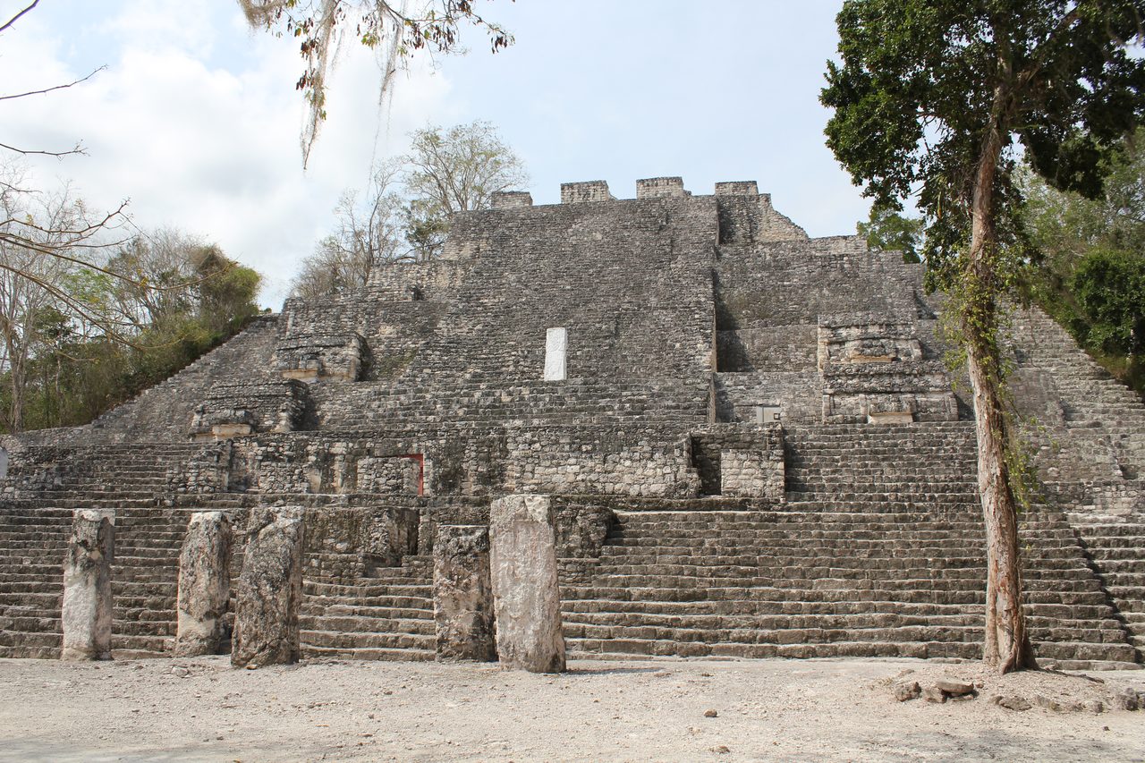
- Structure II, Calakmul Arian Zwegers from Brussels, Belgium, via Wikimedia Commons. CC BY 2.0 Source.
- The Hieroglyphic Stairway, Copan Arian Zwegers from Brussels, Belgium, via Wikimedia Commons. CC BY 2.0 Source.
- El Castillo, Chichen Itza Arian Zwegers from Brussels, Belgium, via Wikimedia Commons. CC BY 2.0 Source.
- Market at Chichicastenango, 2016 Zarqwan, via Wikimedia Commons. CC BY-SA 4.0 Source.
- Building M7-26, Aguateca HJPD, via Wikimedia Commons. CC BY 3.0 Source.
- Card crop of The Great Plaza and North Acropolis, Tikal Bjørn Christian Tørrissen, via Wikimedia Commons. CC BY-SA 3.0 Source.

.jpg)
.jpg)
.jpg)

